

His Majesty King Bhumibol Adulyadej The Great
Chapter 10: Royal Duties in Agriculture and Rural Development
His Majesty the King was an agriculturist and a developer. He recognized that the people, who were farmers, faced numerous problems such as shortages of water resources, unsuccessful cultivation, insufficient farmland, and lack of adequate public health. Therefore, His Majesty initiated comprehensive solutions to these problems, namely:
Development of water resources
Land development
Soil conservation and natural resource conservation
Establishment of development study centers
Establishment of cooperatives
Rice Bank Project
Cattle and Buffalo Bank Project
1. Development of water resources
Mr. Lek Jindasanguan wrote in the book Psychology of Security (1987: 29–46) as follows:
The water resources development projects, undertaken for the benefit of people in rural areas as well as in various local communities, aimed to provide sufficient water for daily consumption, agricultural use, and many other purposes. These projects were among the most important royal duties of His Majesty King Rama IX, which he continuously and consistently carried out.
Which has brought immense benefits to a great number of impoverished people living in remote areas.

Through His boundless benevolence and compassion, His Majesty earnestly desired to help relieve the hardships of the people, enabling them to ease the difficulties of life and livelihood in areas suffering from water shortages for cultivation, or in cases where rainfall was irregular and inconsistent. His intention was to enable the people to stand on their own, develop themselves and their families, achieving first a state of “sufficiency” and eventually reaching a stage of “having enough to live and to use.”
The water resources development projects initiated under the Royal Initiative of His Majesty King Rama IX were undertaken to provide water for farmlands in various regions suffering from shortages, so that cultivation could be carried out throughout the year, as well as for other benefits. Relevant government agencies, such as the Royal Irrigation Department, were tasked with implementing these projects in response to His Majesty’s initiatives, extending them across all regions of the country in accordance with local conditions, topography, and the availability of natural water sources that made construction feasible.
In general, the water resources development projects under the Royal Initiative were fundamental projects aimed at solving the people’s hardships related to water. They arose from His Majesty King Rama IX’s frequent visits to villages throughout the country—in the North, Northeast, South, East, West, and Central regions—which he undertook regularly for about eight months of each year. During these visits, His Majesty learned first-hand the causes of the people’s difficulties, particularly concerning livelihoods in remote rural areas where most were farmers facing shortages of water for both household consumption and agriculture. This resulted in widespread poverty and frequent food shortages. Whenever His Majesty inquired directly with the people during these visits, the overwhelming majority would humbly report to him their suffering due to insufficient or unavailable water for cultivation.
Even during the rainy season or in the main rice-growing period, cultivation could still be damaged due to water shortages at the beginning or end of the season, or during dry spells between rains, resulting in low yields, and in some years, almost no harvest at all. During the dry season, most natural streams and rivers would run dry, leaving no water for cultivation or even for household consumption. In some areas, such as the South, where rainfall is abundant during the rainy season, people would report to His Majesty that their farmlands suffered from excessive water, causing prolonged flooding that prevented cultivation or damaged crops.
His Majesty King Rama IX was deeply concerned about the hardships faced by the people in their livelihoods. Recognizing that water was a critical and highly needed resource for most rural populations—for both household use and agriculture—He devoted His efforts to the development of water resources, aiming to solve the problem of water scarcity. This included ensuring sufficient water for agriculture and daily use, as well as developing water sources for other beneficial purposes in accordance with local conditions. His Majesty believed that when the people and their farmlands had no water-related problems, and when sufficient water was available for both consumption and agriculture, it would improve their living conditions and contribute to the overall success of rural development.
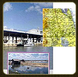
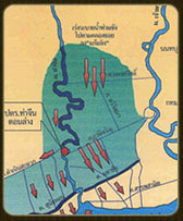
As the Royal Irrigation Department is the government agency responsible for supplying water for agriculture, it received His Majesty’s Royal Initiative to implement water resource development projects nationwide. The first project undertaken by the Royal Irrigation Department under this initiative was the Khao Tao Reservoir Project, involving the construction of an earth dam to block Huai Takad at the coastal village of Khao Tao, Hua Hin District, Prachuap Khiri Khan Province. The reservoir, with a capacity of approximately 600,000 cubic meters, was built to store fresh water for household use and livestock in the village. Construction began in 1963 and was completed the same year. Subsequently, whenever His Majesty traveled to various royal residences and visited people in different regions annually, He provided further Royal Initiatives for the Royal Irrigation Department to plan and implement various water resource development projects continuously across the country, including the North, Northeast, and South regions.
1.1 Types of Water Resource Development Projects under the Royal Initiative
The water resource development projects initiated by His Majesty King Rama IX and assigned to government agencies, such as the Royal Irrigation Department, for planning and construction under the Royal Initiative, can be divided into five types as follows:
1.1.1 Water Resource Development Projects for Agriculture and Domestic Use
These are water development projects constructed by government agencies in response to the Royal Initiative and are more numerous than other types of projects. The design and construction of water resource development projects for agriculture and domestic use in each area must always be planned to suit the local topography and available water sources. This type of water resource development project is further divided into two categories:
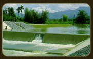
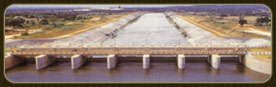
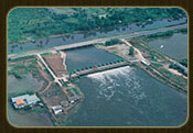
-Reservoir Projects consist of constructing dams to block streams between valleys or hills, allowing large amounts of water to be stored, referred to as “reservoirs.” Spillway structures are also built to control the water level in the reservoir and prevent overflow across the dam. Additionally, water delivery pipes are constructed at the dam to distribute and regulate the amount of water sent to agricultural areas. Reservoir projects are commonly constructed because they can store water during the rainy season as a reserve source for use when needed.
-Weir Projects involve constructing a structure to block the flow of a river or stream, called a “weir,” to raise the water level so that it can be diverted into canals or water channels supplying agricultural areas along both sides of the river. The excess water naturally overflows the weir. Weirs can be built on any natural watercourse as needed, but their full benefit for irrigation is achieved only on rivers with sufficient and consistent water flow during the planting season. On rivers with irregular or unpredictable water flow, weirs cannot provide the same level of benefit as reservoir projects mentioned earlier.
1.1.2 Water Resource Development Projects for Headwater Conservation
These projects involve constructing small weirs at intervals along the headwaters of various watersheds to store water in the streams, similar to small reservoirs. The stored water gradually seeps into the soil along the banks and streambeds, increasing the amount of water retained in the soil at the headwaters. This helps maintain soil moisture for longer periods and effectively supports forest conservation in the headwater areas.
1.1.3 Water Resource Development Projects for Electricity Generation
His Majesty King Rama IX also showed interest in water resource development projects for electricity generation in remote rural areas. He provided Royal Initiatives for relevant government agencies to plan and construct small-scale hydropower projects in several northern regions.
Hydropower projects involve constructing dams to store water. The construction sites for dams and powerhouses must have significant differences in elevation, so that water released from the higher-level reservoir can drive turbines to generate electricity. The water used for power generation can subsequently be utilized for agriculture and domestic purposes.
1.1.4 Flood Mitigation Projects
Construction of Levees
Building levees is a traditional method of flood prevention. In response to the Royal Initiative, the Royal Irrigation Department has constructed levees in several locations. In the South, examples include the Mu-No Weir Project and the Pi-Hleng Weir Project in Narathiwat Province. For Bangkok and its metropolitan area, the Royal Irrigation Department, the Department of Highways, and the Bangkok Metropolitan Administration have jointly constructed levees to prevent flooding from the Chao Phraya River and surrounding canals in the northern and eastern parts of Bangkok, effectively protecting the inner city and economic areas from floodwaters.Construction of Diversion Channels
This involves creating new channels or canals connected to watercourses prone to flooding to divert all or part of the excess water that would otherwise overflow. The diverted water is directed to other rivers or discharged into the sea, as appropriate. His Majesty King Rama IX provided the Royal Initiative for this type of flood mitigation in 1974 to address flooding from the Golok River, which forms part of the border between Thailand and Malaysia. In response, the Royal Irrigation Department excavated the Mu-No Canal in 1975, with a width of 20 meters at the bottom and a length of 15.60 kilometers, significantly reducing flood levels in the area.River Improvement and Restoration
This involves improving and restoring rivers to facilitate smoother water flow or increase the flow speed. During the rainy season, this helps lower water levels and reduce flood damage. Methods include:
Dredging shallow or silted riverbeds to improve water flow
Smoothing riverbanks to prevent obstacles to water movement
Removing aquatic plants, water hyacinths, and other obstructions from the river
Straightening highly meandering rivers by excavating new, straighter channels to facilitate water flow
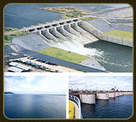
4. Construction of Storage Dams
Building storage dams is one of the key measures for flood prevention, as they retain floodwaters during the rainy season in reservoirs located upstream of the dam. Currently, many such projects have been implemented throughout Thailand under the Royal Initiative. As for nationwide flood control, several projects are currently underway at multiple locations.
Pa Sak River Basin Development Project under the Royal Initiative
Pak Phanang River Basin Development Project under the Royal Initiative
Upper Nakhon Nayok River Basin Development Project, Nakhon Nayok Province
4. Construction of Storage Dams
Building storage dams is one of the key measures for flood prevention, as they retain floodwaters during the rainy season in reservoirs located upstream of the dam. Currently, many such projects have been implemented throughout Thailand under the Royal Initiative. Nationwide flood control measures are also underway at multiple locations.
5. Monkey Cheek Drainage Project

The flood mitigation of areas in Bangkok and its metropolitan region under the Royal Initiative, known as the “Monkey Cheek” project, addresses the natural condition of Bangkok as a low-lying plain. This causes slow drainage during flooding. Many canals have a gentle slope, and numerous waterways are shallow or overgrown with aquatic plants, obstructing the flow of water. These factors collectively contribute to prolonged flooding in Bangkok and the surrounding metropolitan area.
His Majesty King Rama IX provided the Royal Initiative for a flood management system using a method called “Monkey Cheek.” His Majesty explained the concept as follows:
“Generally, when monkeys are given bananas, they quickly peel them and place them in their cheeks, storing almost an entire bunch there. They keep the bananas in their cheeks before chewing and consuming them later.”
This can be compared to flooding, where canals are dug to collect water and store it in retention ponds, similar to a monkey’s cheek, before releasing the water to the sea once the sea level drops.
The Monkey Cheek Project under the Royal Initiative involves draining water from upper areas through north–south canals into large retention ponds near the coast. When the sea level falls below the water level in the canals, water is released from these canals through sluice gates using gravity and pumps to maintain the lowest possible water level in the retention ponds. This allows water from the upper canals to continuously flow into the retention ponds. When the sea level rises above the canal level, the sluice gates are closed to prevent backflow. Following this Royal Initiative, the Royal Irrigation Department studied and developed the Monkey Cheek Project, dividing it into two main components:
5.1 Monkey Cheek Project on the East Bank of the Chao Phraya River
This project collects water from the east bank of the Chao Phraya River, covering Saraburi, Phra Nakhon Si Ayutthaya, Pathum Thani, Nonthaburi, and Bangkok, through various canals. Coastal canals along Samut Prakan Province serve as primary retention ponds, with additional ponds created in suitable vacant areas or marshes. Natural north–south canals, such as Khlong Phra Ong Chao Chai Anuchit, Khlong Bang Pla, Khlong Dan, Khlong Bang Ping, Khlong Tamru, and coastal canals, are used for directing water into and out of the retention ponds.
5.2 Monkey Cheek Project on the West Bank of the Chao Phraya River
This project collects water from the west bank of the Chao Phraya River, covering Ang Thong, Phra Nakhon Si Ayutthaya, Pathum Thani, Nakhon Pathom, Bangkok, and Samut Sakhon. The water is directed into the Mahachai–Sanam Chai Canal and Tha Chin River for discharge into the sea on the Samut Sakhon coast.
In the general area, there were no levees along the Chao Phraya River or parallel to the coastline, and the existing canals connecting to the sea were not adequately controlled. As a result, when the sea level rose, it blocked or significantly slowed the flow of freshwater to the sea, causing severe and prolonged flooding.
His Majesty King Rama IX provided the Royal Initiative to accelerate floodwater discharge to the sea using various methods as follows:
The Monkey Cheek Project on the Lower Tha Chin River is based on the principle of controlling the river by releasing large volumes of water into the Gulf of Thailand when the sea level is low, and closing gates to prevent seawater from intruding upstream when the sea level is high. This multipurpose project is considered highly important for the future.
The Monkey Cheek Project on the Mahachai–Sanam Chai Canal involves constructing closure dams along the canal, building sluice gates, and managing tributaries. This area serves to collect water and floodwater from upper areas and gradually discharge it into the Gulf of Thailand, coordinated with tidal changes, using gravity and appropriately managed pumping systems.
The Monkey Cheek Project on Khlong Sunak Hon includes constructing closure gates along the canal, associated structures, and a pumping station.
The Monkey Cheek Projects represent a positive initiative that helps Thai people avoid disasters and move toward safer, more secure living conditions. His Majesty remarked on flood management:
“Actions have been carried out in the correct direction. Efforts should now be accelerated to improve and increase efficiency, as future Monkey Cheek Projects will be able to assist multiple areas.”
In addition, His Majesty the King provided Royal Initiatives for the treatment and removal of wastewater in Bangkok, other major cities, and provinces through various methods, such as:
-Using water hyacinths to filter impurities from wastewater
-Using clean water to flush out wastewater
-Using the Chai Pattana water turbines for wastewater treatment
-Proper disposal of waste in ways that do not harm the environment, including both underground water sources and air quality
1.1.5 Wastewater Treatment Projects
His Majesty King Rama IX showed great interest in addressing and treating wastewater in communities within Bangkok and other major cities. He provided Royal Initiatives for relevant agencies to collaborate in experimenting with simple and suitable wastewater treatment methods. Currently, wastewater treatment following these Royal Initiatives has yielded satisfactory results and is being implemented in more areas across the country.
The Royal Instructions for wastewater treatment are expressed in simple, well-considered statements. They carry profound meaning and, in some cases, provide guidance on practical methods for implementation, as illustrated in the following Royal Initiatives.
1. Wastewater Treatment by Dilution, or “Good Water Driving Out Wastewater”
His Majesty recommended addressing wastewater by using good-quality water from the Chao Phraya River to push and dilute polluted water, removing it from community water sources in urban areas through various canals, such as Khlong Bang Khen, Khlong Bang Sue, Khlong Saen Saep, Khlong Thewet, and Khlong Bang Lamphu. This method is implemented by opening and closing sluice gates to allow water from the Chao Phraya River to flow in during high tide and drain into the river during low tide. As a result, water in the canals circulates and renews more effectively, naturally improving water quality with a simple, natural approach.
2. Wastewater Treatment by Filtering with Water Hyacinths, or “Natural Kidney”
Makkasan Pond is a large pond located in the heart of Bangkok, excavated by the State Railway of Thailand approximately 68 years ago. It measures 60 × 2.38 × 1.5 meters, with a total water surface area of about 92 rai. The pond serves as a water drainage area and collects wastewater from densely populated communities, including Samsen and Thap Kaeo, primarily consisting of sewage, solid waste, and engine oil from the Makkasan Railway Factory. These wastes have caused sedimentation in the pond, leading to shallowing and resulting in water pollution.
It became a breeding ground for pathogens, causing environmental degradation amid the rapid material development of urban society. His Majesty King Rama IX recognized the dangers of such pollution, which directly affected his people. To address the problem promptly, He provided the Royal Initiative for relevant agencies to collaborate in improving Makkasan Pond. The project aimed to utilize the pond for water drainage and wastewater treatment using a natural filtration system, employing certain plants such as water hyacinths and Indian spinach (Thup Reusi).
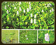
Water hyacinth
Indian spinach (Thup Reusi)
In the case of Makkasan Pond, His Majesty chose to use water hyacinths, a weed that needed to be removed, to absorb impurities and toxins from the polluted water. He emphasized that the project should be carried out economically. As He stated:
“…This Makkasan Pond project is done in a style called ‘for the poor,’ using the existing water hyacinths to absorb filth, thereby cleaning the water naturally. It acts as a natural filter, using solar energy and the natural growth of the plants…”
The Royal Initiative provided a simple approach: pump water from Khlong Samsen into Makkasan Pond from one side and pump it out through another canal, or via the Asok-Din Daeng drainage pipe. Water hyacinths in the pond act as natural filters, absorbing pollutants. When there is a large quantity of water hyacinth, it can be used for compost or fuel, but not for animal feed due to the presence of toxic heavy metals. Using water hyacinth as fuel also helps reduce deforestation.
His Majesty King Rama IX compared Makkasan Pond to the “natural kidney” of Bangkok, storing and purifying wastewater, as well as serving as a reservoir and drainage area during the rainy season. He encouraged the use of water hyacinths, a weed that needed removal, to absorb impurities and toxins from polluted water, combined with mechanical wastewater treatment devices that He had invented. The focus was on simple, cost-effective methods. Today, Makkasan Pond effectively functions as Bangkok’s “natural kidney,” helping reduce water pollution and serving as a research and experimental site for environmental problem-solving. His Majesty conveyed this guidance to the officials:
“In Bangkok, there must be spaces to breathe. Here, we consider this as a kidney that removes impurities and disease. A public park is like a lung, but this functions like a kidney that purifies blood. If the kidney does not work properly, we die. I want everyone to understand the principle behind this concept.”
3. Wastewater Treatment through Biological Processes Combined with Mechanical Aeration, or “Biological Aeration Pond”
Rama IX Pond is a large pond covering approximately 130 rai, with a length of about 1,300 meters. It is located on land owned by the Crown Property Bureau, adjacent to Khlong Lat Phrao, which connects with Khlong Saen Saep in the Huai Khwang district. The area has faced severe and increasing water pollution. Khlong Lat Phrao is one of Bangkok’s main drainage canals, receiving wastewater from communities on both sides. The canal, 20–30 meters wide and about 3 meters deep, contains murky water with dark sediment and emits the foul smell of hydrogen sulfide gas.
His Majesty King Rama IX provided the Royal Initiative, stating:
“…Using only natural methods is not sufficient to improve wastewater treatment. It is necessary to use aeration devices by creating aerated ponds, which employ mechanical aerators to increase dissolved oxygen in the water. This allows aerobic bacteria to decompose organic matter in the water. Wastewater treatment systems using aerated ponds can treat wastewater more effectively than traditional green ponds that rely on natural oxygen from aquatic plants and algae…”
Rama IX Pond
4. Principles of Wastewater Treatment Combining Aquatic Plants with Aeration Systems
His Majesty King Rama IX provided the Royal Initiative to promptly address the issue of polluted water discharged into Nong Han and Nong Sanom in Mueang District, Sakon Nakhon Province. Wastewater treatment at Nong Han involves collecting sewage from communities within the municipal area, which flows into Nong Han near the water supply plant and hospital, and directing it to a discharge point near Phu Mak Suea Crematorium. About 70 percent of municipal wastewater is collected, and a treatment project is implemented using a combination of natural methods and cost-effective technology to accommodate future municipal wastewater discharge.
The wastewater treatment system includes pipes that collect sewage from the municipal area into stabilization ponds. Gravel beds are used to filter suspended solids, help aerate the wastewater, and provide surfaces for microorganisms to attach, thereby reducing organic matter in the wastewater. Screens are also installed to capture solid waste.
5. Principles of Wastewater Treatment Using Sewage Ponds and Phytoremediation at Laem Phak Bia
The Environmental Research and Development Project at Laem Phak Bia, Ban Laem District, Phetchaburi Province, is a research project studying methods for wastewater treatment, solid waste disposal, and mangrove forest conservation using natural methods. Agencies involved in the project include the Chaipattana Foundation, the Office of the Royal Development Projects Board (RDPB), the Royal Irrigation Department, the Royal Forest Department, the Department of Fisheries, Kasetsart University, Mahidol University, Phetchaburi Rajabhat University, and Phetchaburi Municipality.
His Majesty King Rama IX conceived of removing toxic substances, such as heavy metals, from wastewater and using treated water for agriculture, while discharging the remaining water into the sea. He stated: “…In southern Australia, there is a project where wastewater is directed into canals and then into large ponds near the sea, covering several hundred rai, where the water is treated and purified before being released into the sea…” Following this, RDPB and Royal Irrigation Department staff were sent to study wastewater treatment and solid waste management in Australia to adapt the methods appropriately for Thailand.
His Majesty gave his royal approval for the task force to carry out wastewater treatment at Laem Phak Bia, Ban Laem District, Phetchaburi Province. The plan involved constructing drainage pipes to collect wastewater into Khlong Yao, which serves as a sedimentation and trash-catching pond. At this point, plastic bags, fabric scraps, wood debris, and large suspended solids are separated to reduce pollution and decrease the workload on the pumps. The collected wastewater is then pumped from Khlong Yao to Laem Phak Bia for treatment.
6. Wastewater Treatment Using Aeration: “Chai Pattana Water Turbine”
His Majesty King Rama IX was deeply concerned about the hardships faced by the people and personally observed polluted water conditions in many areas, both in Bangkok, its metropolitan vicinity, and other provinces. He provided royal guidance on addressing water pollution, recognizing that the increasing volume of wastewater in the country posed serious environmental and public health risks.
In the first phase (1984–1987), His Majesty used clean water to dilute polluted water and employed natural filtration methods with water hyacinths and other plants, which provided only partial relief.
In the second phase (1988), as water pollution became more severe, His Majesty provided guidance to invent a cost-effective aeration device that could be manufactured domestically, inspired by the traditional “lok,” a folk device used to draw water into rice fields. He then commissioned the Chaipattana Foundation to support the study and development of this aeration device, which became known as the Chai Pattana Water Turbine.
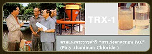
7. Wastewater Treatment Using Physical Processes: “Coagulants”
This method involves treating wastewater by adding chemical coagulants to induce sedimentation, using a specially designed treatment device. His Majesty King Rama IX named this model the “TRX-1.” Various coagulants are used, such as alum, ferric chloride (Fe³⁺), ferric sulfate (Fe³⁺), sodium aluminate, and lime. After coagulation, caustic soda (NaOH) is added to adjust the pH of the treated water.
Before applying this chemical treatment, the quality of wastewater from different sources—such as Khlong Samsen, Khlong Prem Prachakorn, and Khlong Saen Saeb—must be analyzed, particularly for pathogens and heavy metals. The resulting sludge can then be utilized beneficially. In some cases, oxygen gas is also added to enhance treatment efficiency.
Beyond wastewater treatment, His Majesty was deeply concerned with the alternating crises of floods and droughts in Thailand, which prompted him to develop a strategy to address both water scarcity and flood control.
1.1.6 Drought Mitigation Projects
His Majesty King Rama IX was deeply concerned about Thailand’s future water crises, as the country continually faced alternating problems of floods and droughts, causing significant losses to farmers and the general population. It was therefore necessary to construct large reservoirs to serve as water sources for agricultural irrigation during the dry season and to prevent floods during the rainy season, particularly from the Pa Sak and central Chao Phraya river basins. Two large reservoirs were constructed—one on the Pa Sak River and another on the Nakhon Nayok River. These two reservoirs have a combined capacity sufficient for consumption and irrigation needs. The Pa Sak River alone has an average annual flow of approximately 2,400 million cubic meters, with as much as 1,600 million cubic meters during September and October. Unfortunately, much of this water was previously discharged into the sea unused, instead of being stored for agricultural and domestic use.
In addition to various wastewater treatment projects, flood control, and drought alleviation efforts, His Majesty King Rama IX was also aware of problems related to flooding, freshwater, acidic water, and saline water, which particularly affected southern Thailand, especially areas surrounding peat soils and nearby regions, such as the Pak Phanang watershed in Nakhon Si Thammarat Province and the Bang Nara watershed in Narathiwat Province.
He established projects to construct systems for preventing acidic water from peatlands that could harm agricultural areas, preventing saltwater intrusion, and delivering freshwater to support agricultural production for both consumption and irrigation. For these projects, His Majesty devised ingenious concepts and methods to separate different types of water within the same area, demonstrating his exceptional wisdom and expertise in water management.
In addressing drought and water shortages for agriculture, His Majesty King Rama IX exhibited extraordinary skill and personal ingenuity in solving these challenges.
To address water shortages for agriculture, the New Theory approach was implemented, ensuring a continuous water supply throughout the year. This system provides benefits not only for agriculture but also for the economy, society, and environmental quality simultaneously.
Under this New Theory model, farmers divide their land averaging about 15 rai (approximately 6 acres) as follows: 5 rai for rice paddies, 5 rai for field crops and orchards, 3 rai for a water reservoir about 4 meters deep, and 2 rai for housing and other uses. The New Theory aims to enable farmers to achieve self-sufficiency, live economically, and promote local community cooperation.
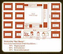
The New Theory
1.2 Royal Initiatives on Water Resource Development
Most of the royal initiatives on water resource development were conceived personally by His Majesty King Bhumibol Adulyadej (Rama IX). He would first study and plan preliminary water development projects on his own. Afterward, he would provide guidance to relevant government officials, who would then consider the plans in detail and carry out the projects step by step, including construction, as appropriate.
Before visiting any village, His Majesty would study the local geography, rivers, streams, and the surrounding villages. He would then formulate preliminary water development projects, often using 1:50,000 scale maps to prepare sources of water to assist the villagers. On some occasions, he would provide the maps of his preliminary projects to the Royal Irrigation Department officials for their review and to prepare initial reports, which would be presented to His Majesty. These preparations would help guide his decisions on how to best assist the villagers during his royal visits.
His Majesty King Bhumibol Adulyadej (Rama IX) always carried a 1:50,000 scale map with him during his visits to villages. On each visit, he would gather information from village headmen, community leaders, and villagers, asking about their occupations, the conditions of rice fields and other crops, rainfall patterns, and the availability of natural water sources, whether sufficient or insufficient.
After carefully studying the information provided by the villagers, if His Majesty found a suitable water development project—one that could be completed within a year, required minimal investment, yet would benefit the villagers significantly—or if it involved repairing damaged earthen embankments and weirs, he would proceed with guidance for implementation.
His Majesty King Bhumibol Adulyadej (Rama IX) would often give instructions to officials of the Royal Irrigation Department to carry out construction projects urgently in front of the villagers who had gathered to welcome him. He also introduced the villagers to the engineers who would assist in providing water. For larger projects that could not be completed within a year and required significant investment, but promised substantial benefits to the local population, His Majesty would outline the initial plan on a 1:50,000 scale map, which he carried with him. He would then review it together with officials from the Royal Irrigation Department and other accompanying personnel, offering his guidance and listening to technical advice and feasibility suggestions from the staff to ensure that the water development project would fully address the villagers’ needs and provide maximum benefit.
The water development guidelines His Majesty provided to the relevant government agencies were meant as general directions for consideration. The agencies were required to study and plan each project thoroughly, in accordance with scientific principles. If a detailed study revealed that a project was unsuitable—such as poor foundation conditions, excessively high construction costs, or discrepancies between the preliminary 1:50,000 scale map and actual topography—the agency could decide not to proceed with the project.
In addition to these royal initiatives, on certain occasions when His Majesty visited rural villages, villagers would respectfully petition him for assistance in securing water sources for drinking and agricultural use. These petitions often contained detailed information about the community’s needs, and some even included sketches or maps to support the request. Villagers frequently submitted petitions that covered multiple issues, such as water, roads, electricity, and schools.
Regarding water sources, if His Majesty King Bhumibol Adulyadej (Rama IX) determined that there was a feasible way to provide water to assist the villagers, he would give guidance to the relevant government officials accompanying him to immediately consider and implement the assistance as appropriate. If a proposed project required further clarification, he would have it collected and studied for additional information to find the best solution. All petitions submitted by villagers were given to the officials of the Royal Household Secretariat who accompanied His Majesty, in order to coordinate with the relevant government agencies to evaluate and plan projects for assisting the villagers as requested. Matters regarding requests for water sources were then forwarded by the Secretariat to the Royal Irrigation Department for consideration.
These initiatives were then organized as water development projects under the Royal Initiative. After careful consideration, the projects would proceed through surveying, design, and construction stages in accordance with His Majesty’s guidance.
In addition to petitions presented personally to His Majesty during his visits to villages, there were numerous rural communities across the country that had not had the opportunity to meet him but still faced shortages of drinking water and irrigation water. These villagers could collectively submit petitions through the Royal Household Secretariat. Upon receiving the petitions, the Secretariat would forward the correspondence along with copies of the petitions to the Royal Irrigation Department for assessment, recommendations, and feasibility studies.
After the Royal Irrigation Department completed a detailed review and planning of the proposed water development projects as requested in the petitions, if the projects were deemed appropriate, they would be recommended as official water development projects under the Royal Initiative. The Department would then proceed with surveying, design, and construction as suitable. Preliminary reports would be sent to the Royal Household Secretariat, which would then present the Department’s findings and project reports to His Majesty for his information and consideration.
In the implementation of water development projects under the Royal Initiative, His Majesty King Bhumibol Adulyadej (Rama IX) generally guided that villagers who benefit from the projects should actively participate in them. This approach not only allows the government to save the nation’s budget and reduce the time required to complete projects, but it also fosters a sense of ownership among the villagers. By taking part in the projects, they are encouraged to maintain and protect the infrastructure, ensuring its long-term usability. Moreover, it helps promote the equitable sharing of benefits arising from the project within the village and between neighboring villages.
1.3 Principles and Methods of His Majesty King Bhumibol Adulyadej in Water Development Projects
His Majesty King Bhumibol Adulyadej possessed exceptional expertise in water development. He established principles and methods for implementing water development projects that were tailored to the local geography. He consistently considered the suitability of water sources and assessed economic and social appropriateness. For example, he would evaluate the geographical conditions based on maps and information obtained from villagers, in order to determine the most suitable form of water development project that meets both the needs of the people and the conditions of the local terrain.
Regarding the suitability of water sources, His Majesty ensured that projects were designed in harmony with the natural water conditions and the geographical characteristics of each area. He would study and calculate the conditions of streams in each location, determining water volume and flow before planning any preliminary projects. During site visits, he would personally observe water flow and the size of the streams to support his decision-making in designing projects appropriate for each water source.
In terms of economic and social suitability, he would consider the construction costs and evaluate whether the investment would be worthwhile, ensuring that the benefits to local villagers would be substantial and sufficient relative to the resources expended.
Regarding local and social conditions, His Majesty King Bhumibol Adulyadej (Rama IX) avoided creating projects that would benefit one group while causing hardship to another. For this reason, in every water development project under the Royal Initiative, he instructed that villagers benefiting from the project should resolve land issues among themselves, assisting those who might be adversely affected, so that government agencies could proceed with construction without having to purchase land. This policy aimed to encourage villagers to actively participate with the government, foster mutual assistance within the community, and cultivate a sense of responsibility to maintain the infrastructure for the long term.
Therefore, in water development projects under the Royal Initiative—such as reservoirs where villagers had encroached on national forest land and refused to agree on land use for construction—His Majesty would suspend work until a proper resolution could be found. There have been several such cases.
Regarding His Majesty’s work in water development, Her Royal Highness Princess Maha Chakri Sirindhorn once gave a special interview on “The Royal Engineer and Engineering Works,” published in the Engineering Journal, Vol. 6, December 1984, a bimonthly journal of the Engineering Institute of Thailand under Royal Patronage. She spoke about His Majesty’s engineering activities, particularly in water development, highlighting details worthy of public recognition. She noted:
“…What people most recognize His Majesty for in engineering is water development and irrigation. From listening to his royal speeches, it is clear that water is the most important factor in agriculture. Even if the soil is poor or there are other obstacles, once the water problem for cultivation is solved, other issues improve accordingly. In water development, he usually integrates both irrigation water for farming and water for domestic use—drinking and household water—into a single comprehensive project. That is, a single project should provide benefits in all aspects. In recent times, it is observed that His Majesty, in planning water development projects, focuses intensely on the details…”
In water management, it is necessary to consider irrigation, flood control, and drainage simultaneously, so that no problems arise. For example, if changes in water levels affect other agricultural factors, such as soil quality, these factors must also be considered in irrigation planning. At the same time, His Majesty thought about whether there would be sufficient water for drinking and household use throughout the year. He did not consider only people but also asked whether cattle and livestock would have enough water.
In regions with multiple types of agriculture, not just rice cultivation, it was essential to plan water use throughout the year for all activities. For instance, in northeastern Thailand, farmers cultivate kenaf. A recurring problem is that villagers soak kenaf in water sources, causing water pollution. Such water becomes unsuitable for irrigation or livestock. Therefore, irrigation planning must allocate water for soaking kenaf, for rice cultivation, and for livestock consumption.
When constructing reservoirs, the planning must also account for local residents. For example, a proposed reservoir site might currently be farmland or residential land. It is necessary to calculate how much farmland will be flooded and weigh the benefits against the losses. Flooding part of the land may increase overall productivity, allowing more land to be irrigated, raising yields from 5–10 tanks per rai to 30–40 tanks per rai. However, if local residents do not consent, even if technically feasible, the project must be delayed. The people living in the area are ultimately the decision-makers.
Sometimes a reservoir may flood one person’s farmland but benefit a group of others. In such cases, discussions must be held with all parties, and land must be redistributed fairly. For example, if someone originally had 5 rai of rice fields, after the reservoir they would have the same area but it would functionally produce as if they had 50 rai. Portions of this benefit must be shared with neighbors who lost land due to the reservoir.
Principles and Methods of His Majesty King Bhumibol Adulyadej (Rama IX) in Water Development Projects can be summarized as follows:
He considered the suitability of the geographic conditions, working with accompanying officials to find ways to implement projects appropriately for the local geography.
He considered the suitability of the water source itself, ensuring that water conditions were compatible with geographic features and the needs of the local people.
He considered the suitability in terms of economic and social aspects, including investment costs and the expected benefits for local residents, ensuring they would be sufficient. His Majesty avoided creating problems for one group of people while benefiting another. Therefore, in every water development project, His Majesty provided the guideline that villagers who would benefit from the project must help resolve issues, such as land disputes, by assisting those who might be adversely affected in an appropriate and mutually agreed-upon manner. This royal policy aimed to encourage the participation of the people with the government, foster mutual support within the community, and instill a sense of ownership so that they would maintain and take care of the constructed facilities.
1.4 Benefits of Water Development Projects under Royal Initiatives
From the time government agencies began constructing water development projects under His Majesty’s guidance until the present, these projects have provided benefits to both the people and the nation, in the short and long term, in various aspects. The benefits can be summarized as follows:
Large areas of farmland within water development project zones established under His Majesty’s guidance now have abundant water, enabling cultivation during both the rainy and dry seasons. This has helped local residents in areas where agriculture previously yielded poor results, even for annual rice crops. During the dry season, cultivation was previously impossible due to water shortages, as it relied mainly on rainfall. With the water development projects, cultivation during the rainy season now yields higher and more reliable outputs. Additionally, there is now water available for cultivation during the dry season as well.
In some areas that were previously prone to flooding, making cultivation impossible or yielding poor results, the drainage projects implemented under His Majesty’s guidance have enabled these areas to be effectively used for agriculture. Crop yields have increased and become more reliable, resulting in higher income for the local residents.
The water development projects initiated under His Majesty’s guidance have led to the construction of numerous reservoirs of various sizes. The Department of Fisheries has stocked each reservoir with suitable species of fish and shrimp. In reservoirs personally inspected by His Majesty, He often released fish, and occasionally shrimp, as well. This has enabled local villagers near the reservoirs not only to have fish for family consumption but also, in some cases, to sell the surplus for additional or primary household income.
These projects have ensured that residents in the project areas have an adequate supply of water for domestic use throughout the year, including for their livestock.
Many agricultural areas and communities, especially in major urban areas, frequently face flooding or water-related disasters, causing significant economic losses to both the private sector and the government. Flood mitigation projects under His Majesty’s water development initiatives have substantially reduced these economic damages—for example, in the eastern floodplains of Bangkok and its metropolitan area.
Hydroelectric projects under His Majesty’s water development initiatives have provided electricity to villagers living in remote mountainous or rural areas, improving their quality of life. If the villagers collaborate to build small electrically powered rice mills, they can use electricity during the day to operate these mills.
These projects have also promoted agro-industrial activities in rural villages by enabling villagers to consistently produce agricultural products under controlled quantity and quality. Such agro-industrial products can be developed into national export goods effectively.
Water development projects for agriculture under His Majesty’s initiative have provided Thai hill-tribe communities with permanent farming areas supplied with water for cultivating temperate crops and rice. This initiative has helped reduce the need for slash-and-burn farming and opium cultivation in upstream forest areas, especially in the northern region, thereby preserving valuable forest resources at the headwaters and simultaneously eliminating domestic opium production, which is a source of narcotics in the country.
Water development projects for watershed conservation under His Majesty’s initiative involve constructing a series of small check dams at the headwaters, along with systems to distribute water from these dams to areas on both sides of the streams. This keeps the land along the streams moist year-round and maintains lush riparian forests, which act as natural firebreaks scattered across the watershed. Such projects help conserve the forest resources at the headwaters effectively and sustainably.
Rural villagers living in areas under His Majesty’s water development projects benefit from increased income and improved quality of life. They may have primary income from farming and supplementary income from fisheries, livestock, or agro-industrial activities. Furthermore, they have access to water for domestic use throughout the year. This improves living conditions in rural communities and allows villagers to earn a honest livelihood. With better living standards, rural families can also support their children’s education at higher levels, raising the knowledge and potential of the younger generation, which strengthens the nation and uplifts rural society as a whole. This represents an immeasurable royal benevolence to all Thai people across the country.
2. Land Development
Thailand currently faces problems with land use, such as improper utilization of land. For example, forests that should be preserved as watershed areas are being encroached upon for shifting cultivation, or land suitable for agriculture is being converted for residential or industrial purposes. These inappropriate uses affect about 30 million rai (Special Coordination Committee, 1988: 93). Moreover, land tenure and ownership issues remain a major problem for farmers. Of the 66.3 million rai of cultivated land, many farmers operate without any legal title. At least 500,000 farming families, or 10.7% of all agricultural households nationwide, are landless. Including rented land—both by farmers with insufficient land and by landless farmers—the total rented area reaches 14 million rai.
Allocating and developing cultivable land for landless farmers is crucial because many rural residents cannot sustain themselves. This lack of land has been a major cause of migration into national forest reserves, leading to extensive deforestation for agriculture. With a growing population and limited arable land, careful planning and systematic development are necessary to maximize the benefits of available land and provide sustainable farming opportunities for those without land. His Majesty the King provided the following guidance to the relevant agencies:
Construct small dams or reservoirs in conjunction with expanding cultivable land for local residents.
When providing land for cultivation, consider the economic, social, and environmental conditions of the surrounding area.
Provide vocational training so that residents can sustain themselves and farm their land effectively.
Organize villages in the form of cooperatives.
Appropriately categorize land use: land suitable for agriculture should be used for farming, and forests should be preserved. Reforestation should follow the “Three Forests” principle: trees for consumption, fruit trees, and trees for fuel.
Use the land for agriculture, and maintain the forested areas appropriately by replanting with three types of trees, known as the “Three-Purpose Forest”: trees for utility, fruit trees, and trees for fuel.
King Rama IX gave royal guidance to relevant agencies to implement projects for organizing and developing agricultural land for people without farmland in various areas. This involved allocating unproductive land, degraded forest areas, and arid land to farmers for long-term cultivation rights, without granting them rights to buy or sell. Modern agricultural technology was applied to improve the land, and cooperative principles and practices were used to develop both the economic and social aspects. Essential infrastructure such as roads, community utilities, and factories for local village produce were also established.

The first farmland development project initiated by royal guidance was the Hub Kraphong Land Development Project in Cha-am District, Phetchaburi Province, established in 1963 (B.E. 2506). The project involved land development, the establishment of an irrigation system, and agricultural experiments conducted on the land for five years. After obtaining successful results, the project then…
ChatGPT said:
Eighty-two landless farming families, along with forty-six families already residing in the area, were relocated to plots of 25 rai per family, forming agricultural villages. They received assistance from relevant government agencies, including the Department of Cooperative Promotion, Department of Agricultural Extension, Department of Agriculture, Department of Land Development, and the Royal Irrigation Department under the Ministry of Agriculture and Cooperatives, as well as the Department of Highways under the Ministry of Transport.
In 1975 (B.E. 2518), King Rama IX granted royal property and donated land in the provinces of Phra Nakhon Si Ayutthaya, Chachoengsao, Nakhon Pathom, Phetchaburi, Suphanburi, Pathum Thani, Saraburi, and Nakhon Nayok to the Agricultural Land Reform Office. The land was used to organize land reform projects to assist landless farmers by granting them the right to use the land (but not to sell it) and to develop cooperative villages.
In addition, His Majesty the King provided assistance to landless citizens through several land development projects, such as the Huai Ongkot Project, initiated under His Majesty’s royal initiative in Nong Prue Subdistrict, Kanchanaburi Province, covering an area of 20,625 rai. Originally, this area was a forest reserve. Each family was allocated 1 rai for housing and 8 rai for farming, with facilities including a market, transport station, community hall, early childhood development center, sports field, various public utilities, a reservoir with an irrigation system covering all agricultural plots, a secondary and vocational school, and a 30-bed hospital.
Within the project area, 4,030 rai were reforested to restore degraded forest areas and prevent further encroachment.
Land Development Projects
2.1 Land Development Project “Huap Krapong” under His Majesty’s Initiative
“…As I mentioned about 10–15 years ago, we began with simple bamboo houses and dirt floors. Later, we had wooden houses with concrete floors. Eventually, we will have proper buildings. The type of house—bamboo, brick, or concrete—is external; what it shows is that we are progressing. And this progress is built on intention, diligence, unity among members, sincerity, and honesty…”
Project commencement year: 1964 (B.E. 2507)
Objectives
To provide sufficient land for members of the vegetable farming group in Khao Yai Subdistrict, Cha-am District, for both their livelihood and residence.
To serve as a pilot project demonstrating the optimal use of natural resources for maximum agricultural productivity.
To promote agricultural practices among farmers according to scientific principles, enabling them to help themselves in line with community development principles.
To encourage members of the allocated land to form cooperative groups in agricultural activities, fostering mutual assistance and laying the foundation for establishing formal cooperatives in the future.
Background
In 1962 (B.E. 2505), forty families living on ninety rai of land in the self-reliant settlement “Kheuan Phet” for vegetable gardening faced low profits and difficulties sustaining their livelihoods. They sought assistance from private and government agencies for support with capital, fertilizers, pesticides, and marketing. During a royal visit to Klai Kangwon Palace, Their Majesties became aware of the farmers’ situation and visited them, granting royal assistance in consumables and production inputs on a continuing basis. His Majesty the King also advised the Ministry of Interior to develop unused or barren land for citizens willing to help themselves and assist one another, establishing stable and sustainable livelihoods. Following this royal guidance, the government implemented the Thai-Israel Rural Development Project in 1964 (B.E. 2507).
Project Location
The project was established on land known as “Hup Krapong” or “Hup Ta Pong” in Cha-am District, Phetchaburi Province, approximately 5 kilometers from kilometer marker 199 of Phetkasem Road. The total area covers 10,000 rai of arid land lacking water resources, which had been abandoned and left fallow.
Implementation Methods
A 500-rai Agricultural Demonstration and Research Center was established to study crop production, explore markets, and gather data before creating a model cooperative village.
Land was allocated to selected members for residence and agricultural activities, with each family receiving approximately 25 rai. Members were granted lifelong farming rights for sustenance but no ownership rights for buying or selling the land.
Members’ occupations were promoted, with a strong focus on agricultural guidance to ensure cultivation followed scientific principles.
Implementation
B.E. 2507–2509, various agencies under the Ministry of Agriculture and Cooperatives, with the cooperation of consultants from Israel, established the Agricultural Demonstration and Research Center of the Thai-Israel Rural Development Project. They conducted studies on crop production, explored markets for the produce, prepared the area, built roads, constructed project buildings, and dug ponds for household and agricultural water use.
B.E. 2510 After gathering sufficient information from preliminary operations, two farmer families were selected to trial the production and sale of various crops on plots of 25 rai per family. The land was divided into irrigated crop plots (vegetables and garden crops such as tomatoes, asparagus, bell peppers, onions, mangoes, rose apples, sapodilla, etc.) of 7 rai, and rainfed crop plots (field crops such as corn, watermelon, millet, sugarcane, etc.) of 18 rai.
B.E. 2511 When the results of production and marketing trials indicated that the crops from the first two families showed a feasible path to success, 120 families from the vegetable garden community were permitted to settle and farm within the project area.
B.E. 2514 As the model farmer village developed successfully, the farmers collectively established the Hub Kraphong Agricultural Cooperative Limited, which was legally registered on 12 August B.E. 2514. The cooperative was formed to jointly manage various village business activities, especially agricultural credit and the purchase and sale of consumer goods for members.
B.E. 2515 Her Majesty Queen Sirikit, the Queen Mother, graciously authorized the Association of Thai Business and Professional Women to purchase materials such as Siamese senna fibers and provide instructors for household weaving for the Hub Kraphong women’s vocational training group. Her Majesty had kindly provided academic instructors to teach skills to the women from the very beginning so that the farmer families could make productive use of their leisure time.
B.E. 2516 A banana drying facility was constructed to produce dried bananas for sale. A cooperative store was established, and a tractor was purchased for soil preparation for cultivation. The cooperative charged a nominal service fee to its members.
B.E. 2517 In response to the Royal Initiative of His Majesty King Bhumibol Adulyadej, an overflow weir was constructed on higher ground to store water in the stream, allowing it to gradually seep through the underground stream to the lower areas of the farmers. This ensured water availability for future pond excavation. A mint oil extraction plant was also established, along with a child nutrition center.
B.E. 2518 The Hub Kraphong Agricultural Cooperative Limited office was constructed to serve as the central hub for coordination among cooperative members, as well as for farmers interested in observing the operations of cooperative members.
On every occasion when Their Majesties, both in official and private visits, came to see the Hub Kraphong Agricultural Cooperative Limited, King Bhumibol Adulyadej and Her Majesty Queen Sirikit, the Queen Mother, graciously provided royal guidance and advice on agriculture. They also inquired into the welfare, happiness, and living conditions of the farmers and their families. His Majesty’s remarks often expressed satisfaction with the excellent cooperation between government officials and farmers in land development, and in cultivating responsibility, diligence, and unity among people, which would lead to progress and stability for the community as a whole.
The operations of the Hub Kraphong Agricultural Cooperative Limited members have gradually achieved success. Members have been able to improve their livelihoods and assist each other as intended by the Royal Initiative. When the time comes for members to stand on their own feet, the various government agencies, which have acted as mentors to the members, will withdraw to carry out similar missions in rural areas across the country, an ongoing duty that never ends.
Project Responsible Party: Hub Kraphong Agricultural Cooperative Limited, Cha-am District, Phetchaburi Province
2.2 Land Development Project According to the Royal Initiative: “Nong Phlap”
Project Start Year: B.E. 2513
Objectives
To utilize natural resources for maximum productive benefit.
To ensure that the people have sufficient land for their occupation and residence permanently.
To promote self-reliance among the people and mutual assistance in ways that benefit both themselves and the community, economically and socially, through living in cooperative villages.
Background
The Nong Phlap Land Development Project according to the Royal Initiative was initiated because His Majesty King Bhumibol Adulyadej saw that many people still lacked permanent land for their livelihood and were increasingly encroaching on government land. Such actions not only destroyed the nation’s forests but also prevented people from sustaining themselves through stable agricultural practices. Therefore, His Majesty intended to test a new land development plan, in which the government graciously granted state land in contiguous valleys in Prachuap Khiri Khan and Phetchaburi provinces for people to use for agricultural occupation. They were granted rights to use the land for generations, but were not given the right to sell it.
Project Location
The project area is contiguous, covering Nong Phlap Subdistrict, Hua Hin District, Prachuap Khiri Khan Province; Huai Sai Nuea Subdistrict, Cha-am District; and Khlad Luang Subdistrict, Tha Yang District, Phetchaburi Province. The area is 33 kilometers from Hua Hin District, totaling 50,000 rai. The terrain is valley plains. Soil quality surveys conducted by the Department of Land Development indicated that approximately 25,000 rai were suitable for cultivation, while the remaining land could be developed for pasture and livestock purposes.
Implementation Methods
His Majesty King Rama IX graciously bestowed the royal policy on the principles and essential methods of implementation, which included the allocation of operational areas, the distribution of land for the people to reside and make a living, and the promotion and support of their occupations through demonstrations and guidance in proper agricultural practices.
Implementation
In 1970–1971, officials from the Land Development Department, together with officials from the Ministry of Interior, conducted land surveys and classifications, as well as assessments of the economic and social conditions of the people living and working on reserved state lands. This was in preparation for the establishment of the Nong Phlap Land Development Project, in accordance with the royal initiative, to provide the people with agricultural livelihoods. They were to become members of the agricultural cooperative village, with hereditary rights to use the land but without rights of ownership or sale, as the land collectively belonged to the members of the agricultural cooperative village.
In 1972, the Accelerated Rural Development Office, in collaboration with the Australian government in the provision of machinery, pioneered the clearing and preparation of 3,540 rai of land, constructed seven standard roads within the project area, and built two farm ponds. The Royal Thai Survey Department supported the work by conducting land elevation surveys, while the Department of Mineral Resources excavated four groundwater wells for domestic use. At the same time, the Land Development Department carried out soil analysis and constructed buildings, the Royal Forest Department prepared tree seedlings and planted trees along the roads, and the Meteorological Department installed weather monitoring equipment.
Between May and October 1972, the Land Development Department organized a land allocation lottery for the people, with each family receiving approximately 25 rai, covering 47 households in total. It was estimated that participating households would be required to contribute 200 baht per rai to the government’s investment, payable in long-term installments not exceeding 12 years. These funds would be allocated as working capital for the Nong Phlap Agricultural Cooperative Limited. Elections were also held for the cooperative’s executive committee to manage member affairs and coordinate with the project center, which provided technical support and guidance. In this first year, the members…
The project was officially registered as the Nong Phlap Agricultural Cooperative Limited on 12 August 1972 and obtained a loan of 50,000 baht from the Cooperative Promotion Fund. The funds were allocated for cultivating 11 rai of corn per member, 4 rai of peanuts per member, and other crops of their choice. When the cooperative closed its accounts on 31 March 1973, it reported a net profit of 31,722.01 baht, enabling members to receive an additional dividend of 5 percent based on their business participation.
In 1973, further land clearing and preparation were undertaken. Terraced plots were developed to mitigate the problem of soil erosion caused by rainfall, and a total of 1,600 rai of land was plowed and prepared for cultivation. At the same time, Cooperative Village No. 1 was established, with 65 additional families selected through lottery to become members. The project center also expanded demonstration plots and experimental cultivation of field crops and vegetables.
In 1974, construction was carried out on roads, water dikes, drainage systems, farm ponds, and groundwater wells. A steel windmill, graciously presented by the Australian government, was installed to pump water from the wells. Additionally, 2,500 rai of new farmland was opened, and 21 more families were admitted as members through lottery.
In 1975, land clearing was extended in preparation for the establishment of Cooperative Village No. 2. However, progress was delayed due to unfavorable weather conditions. Despite this, farm ponds were constructed, and a reservoir in the valley was successfully completed as planned. Land surveys were also conducted in preparation for further development.
On every occasion that His Majesty King Rama IX visited the Nong Phlap Land Development Project, He gave royal advice to the cooperative members, emphasizing the importance of unity in their livelihoods, mutual assistance for the common good, and cooperation among members. His Majesty also provided guidance on coordination between the cooperative and government agencies to maximize the efficient use of the nation’s natural resources, thereby bringing prosperity to the cooperative members and their families.
Summary of the Royal Address of His Majesty King Rama IX,
bestowed upon the project committee and staff during His Majesty’s visit to the Land Development Project under Royal Initiative,
Nong Phlap Sub-district, Hua Hin District, Prachuap Khiri Khan Province,
Monday, 26 May 1975
Project Policy
1.1 For future land allocations (from Village No. 3 onward), the farmland size should be reduced from 25 rai to 15 rai, which should be sufficient for the livelihood of the people (in line with the New Theory).
1.2 The size of farmland allocated does not necessarily have to be equal. If a lottery results in land that is of poor quality or uneven, consideration may be given to increasing the allocated size.
1.3 A plot of 4 rai for housing and a kitchen garden should be adequate.
1.4 Each village should have defined boundaries, and farmland should be located near the village for the convenience of farmers.
1.5 There should be no division of service responsibilities between districts or provinces, as it is the duty of government officials to serve the people. Therefore, mobile medical units from Phetchaburi Province and Prachuap Khiri Khan Province should coordinate and alternate visits to provide medical services to the people throughout the project area.
1.6 Announcements should be made regarding “Reserved Forest Preparation.” Provincial officials and the Royal Forest Department should establish measures to prevent forest destruction and explain to the people the importance of forest preservation. The term “Reserved Forest Preparation” is used to prevent new encroachment on forest land. If the area were declared a “Reserved Forest,” long-term residents would be accused of encroachment and forced eviction, which would create further administrative problems.
1.7 Legal amendments are necessary to grant cooperative villages legal entity status, thereby giving members collective rights to the land allocated by the project. The government’s initiative of land allocation for the people in the form of cooperatives, as pioneered at Nong Phlap, should serve as a model for establishing “multi-purpose cooperatives” in the future.
Development
2.1 The construction of new roads following the natural terrain is appropriate. Preventive measures should be taken to avoid damage from flash floods by installing culverts along natural watercourses.
2.2 Water flow patterns along the foothills should be surveyed, and low-cost check dams should be built to retain water, allowing it to gradually seep into the soil and flow as underground streams down to the lower areas of the project. When wells are excavated in the future, springs will emerge for use.
2.3 Bamboo and acacia trees should be planted in areas with poor soil conditions to improve soil fertility without reliance on chemical fertilizers. Bamboo may also be utilized by members for construction purposes.
2.4 Grass should be planted in areas unsuitable for cultivation to create pastures for the promotion of cattle breeding.
2.5 Once cattle breeding is established, members should be encouraged to use manure and produce compost for their own use, thereby reducing expenses on chemical fertilizers.
2.6 Consideration should be given to future land development policies, such as the appropriate use of government machinery for land clearing on a limited basis.Agricultural Promotion Center
3.1 It has the important duty of fostering unity and compassion among cooperative village members so that they may become self-reliant.
3.2 It is responsible for guiding village committees to assume greater accountability for the well-being of their members.
3.3 It must promote agricultural development in ways that remind members of the government’s contributions in pioneering land development and providing ongoing support.
3.4 It must monitor data to analyze the causes of disparity between higher-income and lower-income members. If illness is identified as a contributing factor, consistent medical check-ups and treatments should be arranged.
3.5 Sub-centers should be established in the villages to serve as coordination points between the main center staff and members. The main center may schedule times for staff to visit sub-centers to meet with village committees and members.
3.6 Sub-centers should seek the cooperation of village committees in collecting member statistics, thereby reducing the time required by the main center staff to gather information individually from members, as is currently practiced.
3.7 Sub-centers should make use of the village community hall in cooperation with the village committee for their operations. The community hall may also serve as a cooperative sub-store to provide services to members, similar to the cooperative store of the Self-Help Settlement in Prachuap Khiri Khan Province, where rice is sold to members at a low price.
3.8 In the future, apart from supporting and promoting agriculture among cooperative village members, the main center could also serve as a facility for various government agencies to conduct research and studies related to agriculture. As for cooperative affairs, it is expected that interested groups or individuals will contact the cooperative village committee directly to observe activities. An example of this occurred on 24 May, when a group of farmers from Chom Bueng District, Ratchaburi Province, visited the Hub Krapong Agricultural Cooperative Limited to observe its operations.
Cooperative Village Committees
4.1 Members should elect about 12 to 16 committee members, including a chairman and section heads, to oversee the collective welfare and coordinate between members and the center staff.
4.2 The committee should be responsible for revoking land use rights of members who wish to withdraw from membership, while ensuring fair compensation for structures and crops on the land. It should also oversee the selection of new members to occupy the vacated land. This process must not be treated as a land transfer between old and new members, but rather as a collection of funds for the benefit of the cooperative, since the land belongs collectively to all members.
4.3 The committee has the duty to resolve village problems with prudence. Representatives from different villages should therefore be appointed to hold meetings and discuss inter-village issues, such as the release of water from higher villages to lower ones. Such discussions—between members and committees, among representatives of different villages, and between village committees and the center staff—serve as training in self-governance and highlight the need for unity both among individuals and groups for the common well-being.
Royal-Initiated Land Development Project “Thung Lui Lai”
Project Start Year: B.E. 2515
Objectives
To address the problem of forest encroachment, preventing further destruction of the nation’s natural resources by conserving watershed areas and protecting the Chulabhorn Dam reservoir from damage through reforestation in areas that had already been encroached upon.
To resettle people who had occupied various areas of the national reserved forest into a permanent settlement, providing them with housing and farmland by allocating land to those eligible for assistance, while relocating those who encroached after the survey to areas outside the national reserved forest.
To develop occupations, promote economic and social advancement of the people by providing necessary public services, encouraging and guiding them to cultivate economically valuable crops that meet market demand, and fostering self-reliance as well as mutual support for the benefit of both individuals and the community as a whole.
Background of the Project
When the Electricity Generating Authority of Thailand (EGAT) constructed a dam across the Phrom River to install hydroelectric generators in Khon San District and adjoining Nong Bua Daeng District, Chaiyaphum Province, a large number of people cleared forest areas for cultivation and settlement along the reservoir’s edge and the newly constructed access roads. If left unchecked, this would have led to complete deforestation in the area. EGAT and the Royal Forest Department therefore collaborated to implement preventive and suppressive measures. Legally, people were not permitted to settle or farm in the designated area. However, since a large number had already moved in, strict enforcement of the law caused hardship. When the authorities imposed restrictions, the settlers lodged complaints with the Revolutionary Council. Later, during His Majesty King Rama IX’s visit and overnight stay at the Phrom Dam area on 21 March 1972, these encroaching settlers collectively submitted a petition to His Majesty.
Later, on the occasion of His Majesty King Rama IX presiding over the inauguration of the Chulabhorn Dam on 3 June 1973, His Majesty offered guidance to the Prime Minister regarding the issue of forest encroachment in the dam area. His Majesty advised the government to allocate a portion of land for development along the lines of the Hub Krapong Village in Cha-am District, Phetchaburi Province, so that the project could proceed in accordance with the royal initiative. While the Department of Public Welfare, which had been assigned as the responsible agency, was in the process of acquiring land for allocation to be submitted for royal approval, the Electricity Generating Authority of Thailand requested cooperation from relevant government agencies to establish operational guidelines in line with the royal initiative. These guidelines included principles concerning land allocation and land tenure, stipulating that the land under this project would remain state property. Project members would be granted land use rights solely as beneficiaries approved to utilize the land. Should a member be expelled from the project, their land use rights would be terminated immediately without entitlement to any compensation. Members, however, would have the right to nominate their spouse or children to inherit membership upon their death.
Administration and Implementation of the Project
To ensure the successful execution of the project, responsibilities were structured hierarchically, comprising the Advisory Committee, the Operations Committee, the Village Operations Centers, and specialized working groups. The operational approach strictly adhered to His Majesty’s guidance, covering all aspects from land acquisition for the project, land development, land allocation, village establishment, provision and promotion of public services, occupational support and development, organization of economic and social structures, to the development of water resources for both consumption and agriculture.
Operational Plan for Fiscal Years 1974–1977
Surveys. In 1974, surveys were conducted on approximately 25,000 rai of land authorized for use under the project. Additional surveys of topography and water sources were carried out around Ban Nong Ikong, Ban Sap Yai Tum, Ban Non Iroi–Mo Tachek, Ban Nong Chiang Rot, and Ban Nong Chan, covering about 33,400 rai in total, to provide data for village planning. In 1975, surveys of the topography and water sources were conducted in the first section of Ban Lui Lai, covering about 5,000 rai. In 1977, surveys continued in the second section of Ban Lui Lai, covering an additional 5,000 rai.
ChatGPT said:
Design. Village layout designs were prepared sequentially for the areas already surveyed. This included the planning of administrative offices, staff housing, and other public utility buildings.
Construction. In 1974, resettlement villages were established at Ban Nong Ikong and Ban Sap Yai Tum for approximately 196 families. The works included the construction of laterite roads 6 meters wide and about 17.5 kilometers long, clearing and leveling around 3,400 rai of forest land within the village area, and developing water sources for both domestic use and agriculture. In 1975, resettlement villages were established at Ban Non Iroi–Mo Tachek, Ban Nong Chiang Rot, and Ban Nong Chan. Works comprised the construction of laterite roads 6 meters wide and about 25 kilometers long, clearing about 5,000 rai of land, developing water sources, and constructing village operation centers, community halls, and health stations. In 1976, a resettlement village was established in the first section of Ban Lui Lai for approximately 300 families, with the construction of about 25 kilometers of road, the clearing of around 5,000 rai of land, the provision of water sources, and the building of a school and one staff residence. In 1977, a resettlement village was established in the second section of Ban Lui Lai, along with the construction of roads, land clearing, water resource development, and the completion of remaining public facilities.
Village Organization. In 1974, surveys were conducted to determine the number of household heads cultivating in 17 villages. Eligible households were allocated land for settlement and cultivation, while those not eligible were relocated to other self-help settlements under the Department of Public Welfare or returned to their original hometowns. In 1975, eligible households in Ban Non Iroi–Mo Tachek, Ban Nong Chiang Rot, Ban Nong Chan, and other villages were allocated land through a lottery system and resettled, while those not eligible were relocated either to their original hometowns or to other self-help settlements. In 1976, the same process was applied to households in the first section of Ban Lui Lai and other eligible villages, with non-eligible households being relocated accordingly. In 1977, approximately 300 eligible families in the second section of Ban Lui Lai were allocated land through the same lottery system as in 1976.
ChatGPT said:
Forest Protection. Measures were undertaken to explore approaches and provide cooperation in preventing illegal logging, as well as in reforestation efforts. In 1975, reforestation was carried out on 2,000 rai outside the project area, followed by an additional 3,000 rai in 1976, and approximately 4,000 rai in 1977.
Promotion and Development of Occupations for Villagers. In 1974, essential agricultural materials and suitable crop varieties were provided to members. Guidance, training, and the establishment of demonstration plots for modern farming methods were organized. Efforts were also made to promote and disseminate soil and water conservation practices, test crop varieties suitable for the locality, and expand these activities further each year up to 1977.
Agricultural Cooperatives. In 1974, an agricultural cooperative was established with approximately 196 members. In 1975, membership expanded to 300, and in subsequent years increased by 300 members annually.
This implementation plan included annual evaluations at the end of each fiscal year to assess problems and explore ways to improve the effectiveness of future plans.
Budget and Operational Funds
The project received its budget and operational funds from the following sources:
State budget allocations prepared by relevant agencies and consolidated by the Electricity Generating Authority of Thailand (EGAT) for approval.
Money or items granted by royal bestowal.
Donations or support from individuals or institutions.
Other income generated by the project.
Project Responsible Agency: Electricity Generating Authority of Thailand (EGAT)
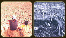
3. Soil Conservation and Conservation of Natural Resources and Environment
3.1 Concepts and Theories on Soil
His Majesty King Rama IX was deeply interested in the conservation of natural resources, emphasizing the restoration of degraded resources to their original state. He recognized that the development and rehabilitation of natural resources directly contributed to agricultural advancement, particularly through various land development projects as follows:
3.1.1 Hardpan Soil Development
This area lies within the grounds of the Mrigadayavan Palace, which King Rama VI declared as royal property in 1923 and 1924. Originally, it was a fertile forest rich with wildlife, especially deer, and thus became known as Huai Sai. Later, local people encroached on the area, clearing the forest for subsistence farming. Over the course of 40 years, much of the forest was destroyed, resulting in irregular rainfall, reduced water resources, and soil degradation. The lack of soil maintenance created an ecological imbalance and increased surface erosion. Moreover, most villagers planted pineapples, which required heavy chemical use, further lowering soil quality. The soil became a mixture of clay, sand, limestone, and minerals compressed into a hardpan layer resembling stone, preventing higher plants from growing. If left unattended, the land would eventually turn into desert. His Majesty therefore studied the potential of vetiver grass.
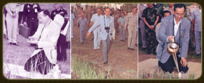
Vetiver grass is a plant with special properties that help prevent soil erosion and conserve underground moisture. Its deep, vertical root system spreads straight into the soil, forming a natural barrier that filters sediment and effectively protects the topsoil. As a native plant of Thailand, vetiver is easy to grow and can be cultivated by farmers themselves. Vetiver provides multiple benefits, including soil and water conservation, environmental and ecological protection, and practical uses such as herbal medicine, fragrance, compost, animal feed, and roofing material. Research and application of vetiver’s benefits gained global recognition when the World Bank acknowledged Thailand’s outstanding and effective use of vetiver. On February 5, 1993, the International Erosion Control Association (IECA) awarded His Majesty King Rama IX the International Merit Award for pioneering the use of vetiver in soil and water conservation. Later, on October 30, 1993, World Bank experts on vetiver presented a bronze-cast image of vetiver roots as an Award of Recognition to honor His Majesty’s dedication to developing and promoting vetiver in Thailand, a contribution that has since been published and shared worldwide.
3.1.2 Sandy Soil Development
This project site was located in Khao Hin Sorn Subdistrict, Phanom Sarakham District, Chachoengsao Province, on 264 rai of land graciously presented to His Majesty King Rama IX by Mr. Thongyoo Udomwattana. Upon visiting the land, His Majesty found that the sandy soil was severely eroded and infertile due to years of forest clearing for monoculture crops such as sugarcane, cassava, and eucalyptus. Once fertile, the land had become barren, unable to support even cassava cultivation. The land had originally been offered for use as a royal residence in the eastern region, but due to its desert-like condition, His Majesty envisioned developing it into a demonstration center showcasing methods for restoring farmland. The project also aimed to promote local handicrafts and arts as a means of supplementing income. This site represented the typical problems and development approaches of the central region and became the first of the Royal Development Study Centers, serving as a model for five additional centers later established in problem-prone regions across the country.
ChatGPT said:
With the genius of His Majesty King Rama IX, the plans He sketched were realized as actual water reservoirs, while the first project trees took root in the soil. Various initiatives were implemented, including the provision and management of farm irrigation, forest rehabilitation and nature conservation, soil and water conservation, livestock raising and pasture development, crop planning and management, as well as training and agricultural support services.
For the study and development at Khao Hin Sorn, where the soil was severely degraded into infertile sand, vetiver grass was planted as embankments to prevent erosion, serving as soil and water conservation measures. The soil was also improved through the use of compost, manure, and green manure.
3.1.3 Development of Peat Soil or Acid Sulfate Soil
When His Majesty King Rama IX made his annual visit to reside at Thaksin Ratchaniwet Palace in Narathiwat Province, many local people presented their grievances about the severe flooding caused by water flowing from the peat swamp forest during the rainy season. This situation prevented them from earning a living, and many farmers lacked arable land. Recognizing these problems, His Majesty extended His assistance and stated in His royal speech, “…This flooded area is of no use. But if the water level can be lowered and drained away, it will bring immense benefits to the people in terms of their livelihoods…”
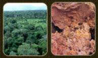
Peat swamp
Acid Sulfate Soil Characteristics
Peat soil is found in peat swamp forests, which are dense evergreen forests located in the southern region of Thailand, where flooding occurs year-round. These peat swamps are naturally formed when seawaves deposit coastal sand into ridges that block water, creating large basins. As plant debris accumulates and decomposes, it becomes organic matter. The subsoil consists of bluish-gray clay containing large amounts of pyrite (FeS). When the soil dries, this compound reacts with air to release gas, which combines with moisture or water to form sulfuric acid. The soil then becomes highly acidic, earning the name “acid sulfate soil.”
To address this problem, His Majesty granted the initiative at the Pikun Thong Royal Development Study Center (Tanyong = Pikun flower, Mas = Gold). The method known as “soil aggravation” was applied to force the soil into its most acidic state, followed by corrective measures. These included controlling the groundwater level alongside drainage, and using marl or line dust to neutralize the soil’s acidity, thereby adjusting the pH level to make it suitable for cultivating various crops.
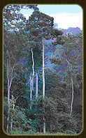
3.2.1 Conservation of Forest Resources
Thailand’s forests have been rapidly destroyed in proportion to population growth and the driving force of a free capitalist economy that relies heavily on forest exploitation. His Majesty King Rama IX offered the concept of integrating the need to conserve and rehabilitate forest resources with economic and social demands, while preventing farmers from encroaching upon and destroying forests. As the amount of forested land decreased drastically, His Majesty sought various methods to increase forest cover in Thailand in a stable and sustainable manner. The approaches He employed for forest conservation included the following:
Planting Forests in Three Ways for Four Benefits
This approach reflects His Majesty’s wisdom in making the most prudent use of natural resources for the greatest, most lasting, and most widespread benefit to the people.
The First Type of Forest Planting is for utilization. Fast-growing species such as eucalyptus, Siamese cassia, rosewood, sesbania, giant acacia, and neem are planted. Their benefits include providing branches for firewood, charcoal, construction, and handicrafts.
The Second Type of Forest Planting is for food production. Various fruit trees and edible plants suited to the area and environment are planted, such as coconut, jackfruit, mango, papaya, banana, as well as vegetables and kitchen garden plants.
The Third Type of Forest Planting is for firewood. The planting area must be calculated in proportion to usage, with replanting and rotational systems to ensure a continuous supply of firewood.
The Fourth Benefit is the by-product of the three types of forest planting, which also helps conserve soil and watersheds. In such planting, different types of trees—timber, fruit, and firewood species—are intermixed. This prevents soil erosion during the rainy season, maintains soil moisture, creates mixed forests, and establishes sustainable ecological balance while meeting people’s needs.
3.2.2 Forest Planting Without Planting
His Majesty King Rama IX, deeply concerned about the rapid decline of forest areas, sought stable and sustainable methods to restore forests through the following approaches:
3.2.2.1 Forest Planting Without Planting
This means that if a suitable site is selected, the forest should simply be left alone. Without interference, the forest will naturally regenerate into a complete ecosystem. In degraded forests or dry dipterocarp forests, stumps will sprout new branches. Although the trees may not be beautiful, they will still grow into large ones.
3.2.2.2 Forest Planting in High Areas
This involves planting seed-bearing trees on hilltops or high ground. When these trees mature and produce pods and seeds, they will disperse and germinate naturally, thereby expanding forest cover.
3.2.3 Watershed Forest Planting or Natural Forest Planting
This involves planting tree species native to the area. Missing species should be replanted to replace those that have disappeared, while avoiding the introduction of non-native or foreign species without thorough study.
3.2.4 Reforestation
His Majesty King Rama IX provided guidance on reforestation suitable to the geography and environment of each area, as follows:
3.2.4.1 Reforestation in Deforested and Degraded Forest Areas
“… Reforestation is urgently needed in degraded areas or watersheds cleared until they become barren hills. Fast-growing species should first be planted along watercourses to restore moisture, which will gradually increase and spread along both banks. This allows trees to flourish and helps prevent forest fires, which occur more easily in dry conditions. In the following years, trees should be planted further upslope, allowing moisture to expand more widely and vegetation to grow well throughout the year …”
3.2.4.2 Reforestation Along Hillsides
“… Various species must be planted to provide multiple benefits—water, fruit trees, construction timber, and firewood, which are essential for farmers. Once harvested, the trees must be replanted immediately in a rotational system …”
3.2.4.3 Reforestation in Watershed Areas on Hilltops and High Slopes
“… Forest planting must include both perennial trees and firewood species. Firewood may be harvested by villagers, but must be replanted regularly. Perennial trees help maintain atmospheric moisture, which contributes to natural rainfall systems, while also preventing soil erosion on slopes during rainfall …”
3.2.4.4 Forest Planting on Mountain Tops
Forests on high, degraded mountains affect downstream watersheds. Tree species with pods should be selected so they can naturally reproduce down to the foothills. Forests should also be planted near reservoirs to improve watershed quality, keep water clean, and provide income for local people, as well as to create habitats for wildlife.
Examples of forest plantation projects include: the Chaipattana Mae Fah Luang Reforestation Project at Doi Tung, Chiang Rai; Nong Phlap, Hua Hin, Prachuap Khiri Khan; forest plantations at Development Study Centers; the Siri Charoenwat Forest Park in Chonburi; and the supplementary natural forest plantation project in and around Phuphan Ratchaniwet, Sakon Nakhon.
In summary, reforestation of degraded forests involves restoration, improvement, and preservation to bring back natural balance. The principles include selecting tree species that benefit local communities, while fostering awareness and appreciation of forest conservation.
Forest planting is not only about putting trees into the ground or planting where rain is available. Proper management is needed, such as using irrigation from external water sources, planting along valleys with check dams, improving soil fertility through topsoil management, and planting vetiver grass across slopes to reduce erosion. Additionally, methods of preventing forest fires should be studied, such as the “wet forest system,” and local people should be encouraged to earn income from forest products and grow crops alongside forest plantations.
Concepts and Theories of Forest Rehabilitation
His Majesty King Rama IX recognized the immense value of water and believed that all elements of the human environment are interdependent, and when applied wisely, can be mutually beneficial. Forest rehabilitation can be achieved through various approaches.
Development of Forests by Using Water Resources to Create Wet Firebreaks, or “Wet Forests”
A “wet forest” is forest development that relies on moisture, keeping the forest green all year round. Moisture spreads across the area where trees grow, forming a wet forest. This simple yet highly beneficial principle is effective in preventing forest fires. Methods to create wet forests include:
1.1 Planting various crops along irrigation canals, relying on both irrigation water and rainfall.
1.2 Planting fast-growing trees along water channels to gradually increase and spread moisture on both sides.
1.3 Building check dams at intervals along small streams to retain water and sediments. The stored water seeps into the soil, expanding moisture more widely.
1.4 Planting forests on high mountains by pumping water to the highest feasible level to support highland forestation.
1.5 Planting banana trees in forest gaps, since their high water content helps act as a natural barrier against spreading fires.
Forest Rehabilitation Using Basic Scientific and Technological Knowledge: “Forest Mountain”
His Majesty the King introduced new dimensions for rehabilitating highland forests, with two main approaches:
2.1 Identifying nearby water sources to expand small dams along headwater streams. This helps spread moisture widely, restoring highland ecosystems to form future “forest mountains.” The growth of diverse tree species will cover the soil, maintain appropriate natural moisture levels, prevent excessive drought, and protect valuable topsoil from erosion and washouts.
2.2 In cases where no natural water sources exist, water should be transported to the highest possible point in order to sustain young seedlings planted on mountains, especially during the dry season when mortality rates are high. Once the seedlings have matured enough to withstand drought, the mountain area will gradually be restored into a moist, forested mountain. This process also helps rehabilitate lower environments, preventing them from becoming arid lands. Pumping water uphill relies on natural energy sources such as solar and wind power, making it cost-effective. A notable example of this initiative is the Huai Sai Development Study Center in Cha-am District, Phetchaburi Province, established under His Majesty’s initiative.
Through His Majesty King Rama IX’s genius and complete leadership qualities, He foresaw and correctly addressed the nation’s challenges. He initiated projects aimed at solving the problems of the majority of Thai people, most of whom are farmers. His determination was to improve the living standards of impoverished, underdeveloped farmers while simultaneously addressing social and environmental issues. The establishment of various Development Study Centers enabled research and experimentation in diverse forms of development, alongside many other projects that greatly benefited the Thai people. His nationwide royal initiatives have left the people with deep gratitude and reverence for His benevolence.
Thus, forest plantation projects have become a vital part of agriculture, creating valuable resources for the future to compensate for deforestation caused by excessive logging and illegal forest encroachment. These projects also help preserve watershed sources essential for agriculture and contribute to flood prevention.
ChatGPT said:
3.2.5 Theory of Mangrove Forest Conservation and Development
His Majesty King Rama IX granted guidance to the Deputy Minister of Agriculture and Cooperatives (Mr. Kosit Panpiemras) during the Royal Plowing Ceremony at Suan Chitralada. His directive emphasized that “Mangrove forests are vital to the coastal and Gulf of Thailand ecosystems. However, Thailand’s mangrove forests are now being encroached upon and destroyed by those seeking personal gain. Measures must therefore be taken to protect, conserve, and expand mangrove resources, particularly Rhizophora (kongkang) species. These mangroves are unique and relatively difficult to propagate, as they depend on tidal systems for growth. Thus, relevant government agencies—including the Royal Forest Department, Department of Fisheries, Royal Irrigation Department, and Hydrographic Department—should collaborate to identify suitable areas for propagation trials and for the establishment of mangrove forests in the future …”
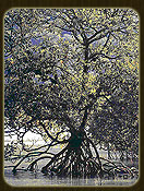
Mangrove forests are known by several names: saltwater mangrove forest, mud forest, or kongkang forest. They are found along Thailand’s seashores and river mouths. Mangrove forests are classified as deciduous forests, with dense tree growth. Each species features either stilt roots or aerial roots, depending on the type of tree.
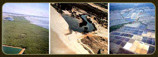
The Encroachment Situation of Mangrove Forests
At present, Thailand has approximately 1,679,335 rai of mangrove forests, a decline of nearly 50 percent from 2,229,375 rai in 1961. Mangrove forests are found along the Gulf of Thailand and the Andaman coast. The most well-preserved areas are in the southern region along the Andaman Sea, while those along the eastern Gulf of Thailand and the central region near the river mouths are in a degraded condition. These areas are dominated by small trees and have been heavily disturbed by human activities such as the conversion of mangrove forests into shrimp farms, salt pans, and industrial zones, similar to what is seen in the eastern region. Shrimp farming in particular has greatly accelerated mangrove degradation. Other causes include mining, agriculture, urban expansion, the construction of ports and roads, as well as various industrial facilities. All these factors have contributed to the drastic and immeasurable decline of mangrove forests in Thailand.
At present, Thailand has about 1,679,335 rai of mangrove forests, a decrease of nearly 50 percent from 2,229,375 rai in 1961. Mangroves are found along the Gulf of Thailand and the Andaman coast. Overall, the mangroves along the Andaman Sea in southern Thailand are the most well-preserved, while those along the eastern Gulf of Thailand and the central region near the river mouths are relatively degraded. These degraded areas are mainly composed of small trees and are heavily disturbed by human activities, such as the conversion of mangrove forests into shrimp farms, salt pans, and industrial zones, similar to what is found in the eastern region.
Shrimp farming, in particular, has severely accelerated mangrove degradation. In addition, mangroves have been destroyed by mining, agriculture, urban expansion, port and road construction, and various industrial developments. These factors have caused the mangrove forest area in Thailand to decline drastically—beyond accurate estimation.
3.2.6 Implementation of Royal Initiatives on Mangrove Forest Conservation and Development
The projects under the Royal Initiative of His Majesty King Rama IX arose from the joint royal initiative with Her Royal Highness the Princess Mother on 16 July 1993. His Majesty entrusted M.R. Disnadda Diskul, Secretary-General of the Mae Fah Luang Foundation, and Mr. Sumet Tantivejkul, Secretary-General of the Chaipattana Foundation, to serve as the central coordinators in carrying out Royal Tree Planting Projects for all the people on the auspicious occasion of the Golden Jubilee of His Majesty King Bhumibol Adulyadej’s Accession to the Throne. His Majesty was firmly determined to restore the environment and sustainably develop natural resources.
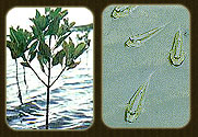
The Royal Forest Projects granted to the Chaipattana Foundation – Mae Fah Luang Foundation consist of three projects:
The Mangrove Forest Community Development Project in Hua Khao Subdistrict, Singhanakhon District, Songkhla Province.
The Mangrove Forest Nature Study Center Project in Yaring District, Pattani Province.
The Feasibility Study Project for Mangrove Forest Rehabilitation in Nong Chik District, Pattani Province.
On the occasion of His Majesty King Rama IX’s royal visit to preside over the inauguration ceremony of the King Taksin the Great Monument in Chanthaburi Province on December 28, 1981, His Majesty graciously bestowed a royal initiative to Mr. Boonnak Saisawang, Governor of Chanthaburi Province. The essence of the initiative was to consider designating suitable areas for the development of fisheries and agricultural occupations along the eastern coastal region of Chanthaburi Province. The funds presented by the people to His Majesty on this occasion were granted as the initial capital for the implementation of the project. Subsequently, on December 30, 1981, His Majesty bestowed an additional royal initiative at Chitralada Villa concerning the projects to be undertaken in Chanthaburi Province. The essence was to consider identifying degraded reserved forest areas or public land to establish the Kung Krabaen Bay Development Study Center under the Royal Initiative as a development center for coastal land areas. The designated area covered Kung Krabaen Bay in Sanam Chai Subdistrict, Tha Mai District, Chanthaburi Province. The Study Center has since conducted research on methods for treating wastewater from black tiger shrimp ponds, promoted environmental conservation, and maintained the balance of natural resources. In particular, it has preserved and collected mangrove forest species, covering an area of 610 rai around Kung Krabaen Bay, as well as the terrestrial forests on the surrounding mountains. Additional mangroves have been planted each year, expanding the total mangrove area around Kung Krabaen Bay to approximately 1,000 rai. This has served as a source for ecological studies and aimed to enable the mangrove forests to absorb nutrients generated from shrimp farming activities. The project has also emphasized the conservation and management of seagrass meadows in Kung Krabaen Bay, ensuring their sustainability as habitats for juvenile and young marine animals, as well as aquatic plants dependent on nutrients from shrimp farming activities associated with the project.
His Majesty King Rama IX placed great importance and showed profound interest in the conservation of natural resources and the environment, the theory of forest rehabilitation, the theory for solving drought and water shortages in agriculture, and the theory of mangrove conservation and development. He graciously bestowed ideas, guidance, and developed various theories of development, such as the New Theory and other royal initiatives mentioned above. These have resulted in the fertility of the land in its natural forms, such as laterite and sandy soils, as well as the treatment of wastewater and the conservation of water to enhance soil moisture and fertility. This is a testament to His Majesty’s perseverance and farsighted wisdom in studying, analyzing, and forecasting environmental and natural resource conservation for Thailand, all for the prosperity and well-being of the people.
4. The Establishment of Development Study Centers
To identify suitable farming methods for each area and demonstrate them to farmers, His Majesty emphasized cultivating crops that were in market demand and suited to local climates, together with raising livestock for food and additional income. M.L. Tawisan Ladawan, Royal Secretary-General (1987: 23–24), explained in a lecture at Chulalongkorn University on November 18, 1986:
“… His Majesty initiated the establishment of Development Study Centers in different regions, bringing together officials from agriculture, social affairs, employment, and education into one place. These centers made it easier for people to gain access to knowledge and support, while also enabling officials to work together more efficiently to deliver benefits. Ultimately, this ensured that the people would directly receive advantages, while officials could fulfill their duties effectively.”
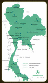
Map showing the locations of the Development Study Centers covering provinces across Thailand
ChatGPT said:
There are six Development Study Centers distributed across all regions of Thailand, namely:
4.1 Huai Hong Khrai Development Study Center, Doi Saket District, Chiang Mai Province
4.2 Phu Phan Development Study Center, Mueang Sakon Nakhon District, Sakon Nakhon Province
4.3 Khao Hin Sorn Development Study Center, Phanom Sarakham District, Chachoengsao Province
4.4 Kung Krabaen Bay Development Study Center, Tha Mai District, Chanthaburi Province
4.5 Huai Sai Development Study Center, Cha-am District, Phetchaburi Province
4.6 Pikun Thong Development Study Center, Mueang Narathiwat District, Narathiwat Province
The objectives of establishing these Development Study Centers were to conduct research, experiments, and studies on local agricultural problems, both theoretical and practical, as well as to explore suitable approaches and methods of development consistent with the environment and the occupations of the local people. Once effective solutions or new techniques and innovations were discovered, they would be demonstrated within the centers. Issues that remained unresolved continued to be studied, as each problem varied in complexity. Eventually, local residents, along with those from nearby areas, could visit the centers to learn about new scientific methods through comprehensive development demonstrations, thereby gaining knowledge on more efficient livelihoods. In addition, they could apply for training in agriculture, household industries, and traditional crafts. The activities of each Development Study Center resembled a living natural museum, where students, university scholars, and the general public could come for educational study tours as well as recreation. Another important mission was to disseminate the results of the studies in the form of development methods to other areas within the same region, eventually expanding the benefits more widely. If any region experienced particularly severe or unique problems, branch centers could be established with full support from the main centers.
Details about the six Development Study Centers are drawn from the book “Development Study Centers under Royal Initiative,” published by the Committee for Coordination of Royal Development Projects (CCRP) and the Bureau of the Royal Household Secretariat (1984: 5–46).
4.1.1 Huai Hong Khrai Development Study Center under the Royal Initiative, Doi Saket District, Chiang Mai Province
Northern Region: Degraded Watersheds
At present, the watershed areas in the northern region of Thailand have deteriorated and can no longer provide full benefits. Although various agencies have conducted studies and attempted to develop these watersheds, the research findings have not been widely applied, and the problems in watershed areas have continued to intensify.
Royal Initiative: Origin of the Project
His Majesty King Rama IX was well aware of these problems. On December 11, 1982, His Majesty granted the initiative to establish the Huai Hong Khrai Development Study Center in Doi Saket District, Chiang Mai Province. The objective was to use the center as a hub for studying and identifying suitable models for watershed development, which could then be disseminated for public application. In particular, the initiative emphasized watershed development through irrigation systems to complement the “Three Kinds of Forests for Four Benefits” approach (planting forests for utilization, fruit, and fuelwood, using water from reservoirs, relying on rainfall, and planting along valley lines with check dams to retain moisture) and using watersheds for economic purposes.
Regarding development activities, His Majesty directed that the upper area above the reservoir should focus on forest and watershed development, the lower area on fisheries, and the middle area on livestock and agriculture.
After receiving the Royal Initiative, relevant agencies held consultations to implement the project. A management committee for the Huai Hong Khrai Watershed Development Study Center was established, with related agencies participating as members. In addition, subcommittees for master planning and local-level operations were formed to ensure that the center’s activities aligned fully with His Majesty’s intentions.
Study Center: Site Conditions
The Huai Hong Khrai Development Study Center is located within Khun Mae Kuang National Reserved Forest, Doi Saket District, Chiang Mai Province, covering an area of 8,500 rai. On November 8, 1983, the Cabinet approved the utilization of this land for the project. The general topography is mountainous forest, with some relatively flat areas along both sides of the Huai Hong Khrai stream. The northern section consists of well-preserved mixed deciduous forest, suitable for watershed conservation studies. The central and southern sections are composed of degraded deciduous dipterocarp forest, making them suitable for agricultural development studies.
Main Tasks
The center’s activities include:
Construction of reservoirs to support various operations within the center.
Studies on watershed development and conservation, including maintaining watershed moisture, forest development, and wildfire control using wet firebreaks supported by irrigation and rainfall.
Studies on livestock development, focusing on dairy cattle and pasture management.
Studies on crop cultivation suited to the northern region, with demonstration and experimental plots for integrated farming, identifying models that villagers can adopt from subsistence to self-sufficiency levels.
Studies on fisheries development, focusing on fishery management, experimentation, and demonstration of aquaculture such as cage culture in reservoirs, household fishponds, proper fishing gear use, and sustainable aquatic resource utilization.
Studies on agro-industry development, including processing industries to expand agricultural outputs.
Implementation of the Royal Initiative: Irrigation Work
Two reservoirs were constructed: Huai Hong Khrai Reservoir 1, with a storage capacity of 250,000 cubic meters, and Huai Hong Khrai Reservoir 2, with a storage capacity of 900,000 cubic meters. In addition, an 8-kilometer water pipeline with a 0.30-meter diameter was built to divert water from the Mae Lai stream to Huai Hong Khrai Reservoir 1.
Construction of Water Supply Systems
A main water pipeline with a diameter of 0.30 meters was constructed from Huai Hong Khrai Reservoir 1 to Huai Hong Khrai Reservoir 2, covering a distance of 3.2 kilometers. Another main pipeline, 0.40 meters in diameter, was built from Reservoir 2 to agricultural areas, spanning 5 kilometers. In addition, 80 small check dams were constructed for water storage.
Forest Development Studies
Boundary surveying of the project’s 8,500-rai area was completed, and reforestation was carried out using the “Three Forests for Four Benefits” approach, with 28 species of trees planted.
Agriculture and Agro-Industry
Intensive farming research covered 50 rai, cultivating various crops including fruit trees (pomelo, mango, lime, custard apple), agro-industrial crops (paper mulberry, bael, Indian gooseberry), and fuelwood species (cassia, neem).
Crop experimentation and testing also covered 50 rai, where land was cleared, plowed, and prepared with soil and water conservation systems. Crops planted included macadamia, mango, lychee, upland rice, test rice varieties, soybean, mung bean, and maize. Demonstration vegetable plots were prepared. Facilities for mushroom cultivation were also built, including mushroom houses, spawn incubation units, steam sterilization equipment, and composting yards. Mushroom trials included oyster, angel, ear, and button mushrooms.
Livestock and Dairy Development
A 200-rai area was designated and planted with forage crops. A dairy barn was constructed, equipment provided, and dairy cows acquired.
Fisheries Demonstration and Water Resource Management
A fisheries farmers’ leader group was established. Fish fingerlings of various species were released into the reservoirs. Experiments were conducted on raising both red tilapia and common tilapia in circular cement ponds, as well as testing the culture of bighead carp.
ChatGPT said:
The Huai Hong Khrai Development Study Center under the Royal Initiative serves as the northern regional hub for demonstrations, training, and dissemination of knowledge to both government officials and the public. Its focus is on models for watershed forest development, maximizing the benefits of watershed forest use, and forest and watershed conservation, including maintaining upstream moisture, forest development, and fire prevention through wet firebreak systems using irrigation water. The center also showcases integrated development models in dairy farming, agriculture, agro-industry, and fisheries management in simplified forms that local people can readily apply in their villages. Furthermore, it highlights that even arid and degraded lands can be developed and utilized productively with proper management. This center also exemplifies inter-agency collaboration among government departments working together toward common development goals.
4.2 Phu Phan Development Study Center under the Royal Initiative, Mueang Sakon Nakhon District, Sakon Nakhon Province
Isan: What is the major problem?
It is widely recognized that the Northeastern region, or Isan, is the largest region of Thailand in terms of both area and population. It covers a total of 106.4 million rai, or 170,218 square kilometers, accounting for 33.1 percent of the country’s total land area. In terms of population, by 1983 Isan was home to 17 million people, representing 34.2 percent of the national population. The region consists of 19 provinces: Kalasin, Khon Kaen, Chaiyaphum, Nakhon Phanom, Nakhon Ratchasima, Buriram, Maha Sarakham, Yasothon, Roi Et, Loei, Si Sa Ket, Sakon Nakhon, Nong Khai, Surin, Udon Thani, Ubon Ratchathani, Mukdahan, Nong Bua Lamphu, and Amnat Charoen. Geographically, most of the region is a plateau 100–200 meters above sea level, with predominantly sandy soils. Each province within Isan has varying geological structures and economic activities, and for academic convenience the region is divided into upper and lower Isan. Regarding natural resources—forests, soil, water, and minerals—the region is less fertile than others, especially in terms of soil and water, the two most critical factors for agriculture. The soils are generally of poor quality, while natural water sources are inadequate and rainfall is lower than in other regions. This has given rise to the often-heard description of Isan as the driest region of the country.
The agriculture of the Northeast has not been as productive as it should be, resulting in this region becoming the poorest in the country due to low income levels. As a consequence, impoverished people began to encroach upon and destroy the forests. This happened, firstly, because logging could ease poverty to some extent, and secondly, because it provided additional farmland for cultivation. However, such short-term solutions have caused long-term negative impacts: the soil lost its moisture due to the lack of forest to retain water, rainfall decreased, droughts became more severe, flash floods occurred, and soil quality deteriorated. These problems reflect not only the inadequacy of natural resources for production but also the farmers’ lack of knowledge in proper agricultural techniques, which could otherwise increase productivity. Moreover, farmers lack knowledge in marketing, since agricultural products often suffer from low prices. Therefore, farmers should be equipped with the ability to add value by processing raw products into agro-industrial goods, thereby ensuring more stable income.
Royal Initiative: The Beginning of the Project
The results of past national development have shown that different regions of Thailand have not benefited equally, due to differences in geography, natural resources, traditions, lifestyles, and education. Therefore, applying the same model of development everywhere cannot be effective. His Majesty the King recognized the importance of first studying the local conditions and way of life of the people in each region in order to design development approaches that are appropriate and practical. Consequently, His Majesty initiated the establishment of Development Study Centers in various regions of the country. For the Northeast, the “Phu Phan Development Study Center under the Royal Initiative” was established at Ban Na Ngokhao, Huai Yang Subdistrict, Mueang District, Sakon Nakhon Province, to serve as a model for solving problems of drought, poverty, and sustainable resource management suited to the specific conditions of the Northeast.
On November 25, 1982, His Majesty the King graciously granted a royal initiative for the Royal Irrigation Department to consider developing a water supply project in support of the Phu Phan Development Study Center under the Royal Initiative, Sakon Nakhon. The purpose was to provide facilities for research and experimentation in agricultural development appropriate to local conditions, thereby creating models for farmers to adopt and apply in their own practices.
Following this royal initiative, the Ministry of Agriculture and Cooperatives submitted a request for Cabinet approval to establish a Project Administrative Committee for the Phu Phan Development Study Center under the Royal Initiative. On October 4, 1983, the Cabinet approved the formation of this committee, assigning it important responsibilities: to define objectives, policies, targets, and management guidelines, as well as to oversee plans, monitor progress, and resolve obstacles in project administration. The committee held its first meeting on December 9, 1983, where it agreed to establish a Master Plan Subcommittee. This subcommittee, chaired by the Deputy Director-General of the Royal Irrigation Department with the Director of the Office of the Royal Development Projects Board as Vice-Chairman, was tasked with formulating objectives, strategies, and targets, and drafting the project’s master plan in line with the royal initiative.
Facts: Location and Area
The Phu Phan Development Study Center under the Royal Initiative is located at Ban Na Ngokhao, Huai Yang Subdistrict, Mueang District, Sakon Nakhon Province, about 10 kilometers west of Sakon Nakhon town. The center covers approximately 2,100 rai, with a surrounding forest development zone of about 11,000 rai, situated within the Phu Lom Khao and Phu Phek National Reserved Forests. The central area is an alluvial plain formed by deposits from ancient waterways, primarily used for rice cultivation. Beyond this are upland fields and dry dipterocarp forest, with some areas encroached upon for crops such as cassava and cotton. The soil is generally sandy loam. Several streams flow through the project area, including Huai Diak, Huai Tat Hai Yai, Huai Yang, and Huai Rai, as well as Huai Diak Reservoir, constructed by the Royal Irrigation Department with a capacity of 4 million cubic meters. This reservoir can irrigate approximately 5,500 rai in the upper part of the project. Additional water resources have also been developed to further support agricultural and forestry activities in the area.
Objectives
To ensure that the operations of the Center proceed effectively and in accordance with the royal initiative, four main objectives were established:
To serve as a center for studying and experimenting with various agricultural development methods appropriate to local conditions, thereby creating models for farmers to apply in their own areas.
To promote the maintenance and development of forests within the Center’s surrounding zone, supported by an irrigation system.
To encourage the cultivation of economic crops and the processing of agricultural products into agro-industrial goods.
To support the development of agricultural occupations—such as crop cultivation, fisheries, and livestock—so that farmers may achieve stable livelihoods and sufficient household income.
Implementation of the Royal Initiative
Irrigation Works
Construction of reservoirs and water distribution systems included the Huai Tat Hai Yai Reservoir and the Phu Mai Ruak Reservoir, both designed to provide water for the Center’s operations. Additionally, the Huai Wian Phrai Reservoir, together with a pipeline distribution system, was constructed to supply approximately 100 rai of community forestry plots and to supplement the Lat Kachoe Reservoir. Furthermore, 20 small check dams were built along various streams in cascading arrangements to enhance soil moisture and restore water retention in forested headwaters.
Model Village Development (Ban Na Ngokhao)
Village infrastructure improvements were carried out, such as resurfacing roads with compacted laterite soil.
Agricultural Development Studies
Studies and trials were conducted on diverse crops, sericulture through mulberry cultivation, and mushroom production.
Demonstration, Promotion, and Development of Water Resources for Fisheries
Activities included pond excavation, construction of concrete tanks, and wooden fish cages to demonstrate aquaculture techniques. Rice fields were adapted for integrated rice-fish farming, and pigsties were constructed to promote integrated pig-fish farming systems. Training programs for farmers were also provided.
Promotion of Household Industries
Support was given to household industries such as blacksmithing for the production of knives and agricultural tools, as well as the promotion of traditional hand weaving.
Livestock Development Studies
Activities focused on developing areas for growing animal feed crops and improving livestock farming practices.
Soil Improvement and Development
Soil quality was enhanced through the production of compost and other soil enrichment measures.
Forestry Development Studies
These included forest conservation, enrichment planting in degraded forest areas, and rehabilitation of natural forests. Land-use efficiency was improved by allocating land to model farmers in the form of community forestry villages, alongside planting fuelwood and utility trees, and promoting lac cultivation. Following the establishment of the Center, it became a regional hub for training and disseminating knowledge to government officials and farmers in Northeastern Thailand. The project also contributed to the conservation of approximately 11,000 rai of forest resources in the Phu Lom Khao and Phu Phek national reserve forests, which serve as important headwater sources. Furthermore, it created opportunities for villagers to increase their income and supported the development of local communities in multiple dimensions.
4.3 Khao Hin Sorn Development Study Center under the Royal Initiative, Phanom Sarakham District, Chachoengsao Province
Eastern Region: Persistent Challenges
Although Thailand has already adopted systematic rural development planning, certain areas in the eastern part of the central region remain impoverished. This highlights the fact that some rural populations have received little to no benefit from the development process. Contributing factors include the lack of land ownership rights, unfavorable climate and arid conditions, limited water resources, and inadequate knowledge of new technologies. As a result, natural resources have often been misused, leading to deterioration in both the environment and the quality of life of local residents. These conditions point to the need for clearly defined study directions to guide the proper allocation and mobilization of existing resources for sustainable development.
In the eastern region, natural resources have suffered extensive degradation, beginning with soil fertility loss caused by the cultivation of cash crops that require heavy fertilizer use, particularly cassava. Deforestation has further worsened conditions, compounded by chronic water shortages for consumption, household use, and agriculture. These problems require solutions, improvements, and well-designed development strategies suited to the region’s characteristics.
Royal Initiative: The Beginning of the Development Study Center
On August 8, 1979, His Majesty King Rama IX visited Khao Hin Sorn Subdistrict, Phanom Sarakham District, Chachoengsao Province, where local residents had graciously presented approximately 1,227 rai of land. Having observed and fully understood the difficulties faced by the people, His Majesty gave the initiative to use the land as a Development Study Center in agriculture, with the aim of addressing local problems and providing opportunities for interested villagers to gain knowledge and apply it in improving their own farmlands.
Following this royal initiative, relevant government agencies consulted together to design a project management structure. A board was formed, comprising representatives from various government agencies and expert advisors, to oversee implementation. The project was planned as a six-year program, spanning 1981–1986.
The Development Study Center: Facts and Conditions
Location and Site Characteristics
The Khao Hin Sorn Development Study Center is located in Khao Hin Sorn Subdistrict, Phanom Sarakham District, Chachoengsao Province, covering an area of 1,227 rai, with an additional 40,000 rai of surrounding land incorporated into the development area. About 50 percent of the terrain is nearly flat, interspersed with undulating low hills. Its boundaries are as follows:
North: adjacent to Phanom Sarakham–Kabin Buri Highway
East: bordered by Khao Na Mod and Khao Hin Sorn Village
West: adjacent to Ko Khanun Subdistrict and Khlong Tha Lat
South: bounded by a line parallel to the Phanom Sarakham–Kabin Buri Highway, extending approximately four kilometers inward from the road.
Soil conditions in the area are generally poor, with low fertility. Farmlands can produce only moderate yields of field crops and rice, making soil and water improvement essential. The land suffers from significant erosion and faces water shortages during the dry season, though in the rainy season there are a few natural water sources. The population benefiting from the development numbers about 1,000 families, the majority of whom are farmers. Land tenure is relatively secure, with approximately 75 percent of households owning their own farmland.
Objectives of the Project
To raise the income levels of local residents in the project area and nearby regions to a sufficient standard of living, targeted at about 20,000 baht per household per year.
To serve as a model area that can guide the development of other regions.
To function as an academic research site for exploring ways to improve agriculture and farmer livelihoods in the eastern region, particularly in Chachoengsao and Prachinburi provinces.
To provide a training center offering agricultural knowledge and specialized handicraft skills to farmers.
To act as a source for producing and distributing improved crop varieties and livestock breeds for farmers.
To serve as a learning center and recreational site for the general public.
Implementation of the Royal Initiative
Various government agencies collaborated in carrying out the project, as follows:
The Royal Irrigation Department constructed seven reservoirs, both within the project site and in nearby farming areas:
Huai Chek Reservoir: capacity 120,000 cubic meters
Huai Yaek 1 Reservoir: capacity 9,000 cubic meters
Huai Yaek 2 Reservoir: capacity 92,000 cubic meters
Samrong Tai Reservoir: capacity 625,000 cubic meters
Upper Huai Samrong Reservoir: capacity 608,000 cubic meters
Upper Huai Nam Chon Reservoir: capacity 1,800,000 cubic meters
Huai Man Pla Reservoir: capacity 250,000 cubic meters
Royal Forest Department
Established forest plantations, arboretums, botanical gardens, herbal gardens, and fast-growing tree plots. The department also promoted awareness among farmers of the importance and benefits of forestry, and set up tree nurseries to produce seedlings for distribution to farmers.
Department of Fisheries
Focused on conserving aquatic resources, training farmers on increasing aquatic productivity, demonstrating fish farming techniques, and producing and distributing fish fingerlings.
Department of Livestock Development
In collaboration with the Committee for Coordination of Royal Projects and Charoen Pokphand Company, the department trained farmers to increase livestock productivity. It also demonstrated and promoted pasture development, livestock breeding, and genetic improvement. Additionally, it expanded cattle and swine production and established a Cattle and Buffalo Bank to provide farmers with livestock through loan or installment schemes.
Land Development Department
Conducted soil surveys, classified land tenure, and planned land use. It also assessed the economic and social conditions of farmers. Demonstrations included soil and water conservation techniques, soil improvement methods to increase productivity, and appropriate erosion control measures to counteract severe soil degradation in the region. The department produced and distributed plant seeds for soil conservation and fertility enhancement, while also training farmers in composting. Farmers were encouraged to produce and use their own organic fertilizer to improve soil quality.
Department of Agriculture
Demonstrated crop varieties suited to local conditions, particularly drought-tolerant plants such as cashew, as substitutes for cassava. It also introduced different rice varieties, rubber trees, and the use of agricultural engineering tools powered by natural energy sources.
Department of Agricultural Extension
Focused on promoting and demonstrating the propagation and cultivation of fruit trees and household vegetables. It served as a training center for propagation techniques, planting methods, pest control, and care for fruit trees, perennial crops, field crops, and vegetables. Importantly, it became a central hub for collecting and conserving high-quality mango varieties from across Thailand.
Chachoengsao Province
Was responsible for the Khok Hin Son Development Study Center area. The province facilitated the operations of government agencies working in the area, established a coordination center to welcome visitors, host meetings, and train farmers. It also organized agricultural markets to sell produce from the project and set up stores to provide high-quality agricultural supplies.
Royal Initiative Herbal Forest Project
Collected medicinal plant species for cultivation so that people could study and grow them for household medicine. Some species were also household vegetables, helping improve family economies. At present, the project organizes training programs to disseminate knowledge to the public about the benefits and properties of herbal plants.
Kasetsart University
Was responsible for disseminating the project’s outcomes in various formats.
Department of Community Development
Trained farmers in traditional handicrafts such as basketry and hand-weaving, and promoted these as supplementary occupations to increase income.
Department of Public Works
Constructed water supply systems to provide clean water for domestic consumption.
Cooperative Promotion Department
Handled cooperative activities such as operating rice mills to support local farmers.
Provincial Electricity Authority
Installed and provided electricity services for lighting.
First Army Region
Supported security efforts in parallel with development activities.
Accelerated Rural Development Office
Constructed roads within the project area.
Department of Vocational Education
Provided significant support by establishing the Chachoengsao Agricultural College. The college offered vocational agriculture programs at both the Certificate (Por Wor Chor) and Higher Certificate (Por Wor Sor) levels. It also supported the development of agricultural occupations in various aspects.
In addition, the Khao Hin Son Development Study Center received extensive cooperation from various private organizations that provided assistance and support. For example, Caltex Oil (Thailand) Ltd. donated a solar power converter to pump water into a reservoir located on a hill, from which water could be released to irrigate the lower areas. To line the reservoir, Thai Petrochemical Industry Co., Ltd. contributed LDPE plastic sheets, which were installed under the guidance of the Thai Society of Agricultural Science. Usa Industry Co., Ltd. collaborated in building wind turbines to harness natural energy for pumping water. Thai Pipe Industry Co., Ltd. supported the project by supplying water pipes. Charoen Pokphand Co., Ltd. constructed pigsties and provided pig breeds. Furthermore, Japan graciously presented a modern rice mill, fully installed and now in operation, serving local farmers.
This project is exemplary in demonstrating close collaboration among government agencies, state enterprises, and private organizations. Another remarkable aspect of the center’s operations is that every participating unit adheres strictly to the King’s initiative—implementing methods that are practical, correct, economical, and ultimately most beneficial. As a result, these approaches can be applied directly by farmers. Since its establishment, the Khao Hin Son Development Study Center has welcomed more than 10,000 farmers, local residents, students, teachers, and foreign visitors annually, who come to observe its operations and receive training. Beyond measurable numbers, the most valuable outcome has been the growing confidence of farmers within the project area. They have developed determination, perseverance, and hope to improve their farmland in line with the royal initiative, which envisioned the center as a model of agricultural and vocational development. The knowledge gained has enabled farmers to increase production and income, thereby raising their families’ living standards and enhancing social well-being.
With the establishment of the Khao Hin Son Development Study Center, numerous benefits have been realized, including:
The project area and its surroundings have become more humid, alleviating drought conditions.
Residents within the project area and nearby communities have gained greater knowledge and skills in both agriculture and special vocational fields, thereby increasing their income.
The outcomes of the development activities serve as examples for people in the eastern region to apply to their own localities.
The center provides educational support to vocational students at both the certificate and diploma levels in agriculture, offering knowledge in both theory and practical applications.
It serves as a research site for testing new plant varieties and as an experimental center for breeding aquatic animals, poultry, and livestock.
It has become a tourist destination, attracting more than 10,000 visitors annually.
4.4 The Kung Krabaen Bay Royal Development Study Center, Tha Mai District, Chanthaburi Province
The Eastern Seaboard: Certain Persistent Problems
Although the eastern coastline, stretching continuously for 3,675 kilometers, appears to be one of the richest natural resource areas in the country—providing livelihoods, generating products, and contributing to national income through agriculture, plantations, orchards, forestry, minerals, mangroves, and fisheries for generations—these resources remain finite. Their renewal requires time and appropriate methods. Yet, as science, knowledge, and technology have advanced, natural resources have been destroyed at an even faster rate.
In recent decades, the deterioration of farmland has reduced crop yields. Mangrove forests, once vital as food sources and breeding grounds for aquatic life, have been encroached upon and destroyed, leaving barren, unproductive land. The modernization of fishing equipment has rapidly diminished marine resources in Thai waters. The decline of areas once abundant in natural wealth has adversely affected both the livelihood of local communities and the overall national economy. Furthermore, these problems are likely to intensify in the years to come.
Royal Initiative: The Beginning of the Project
His Majesty King Rama IX, concerned about the difficulties faced by the people, initiated the idea of studying coastal land development. The purpose was to guide the public to gain knowledge and recognize the importance of proper utilization and conservation of natural resources. His Majesty thus entrusted the initiative to Mr. Boonnak Saisawang, then-Governor of Chanthaburi Province, during the Royal visit to preside over the inauguration of the King Taksin the Great Monument in Chanthaburi on December 28, 1981. In summary, His Majesty advised that a suitable coastal area be selected for a project focusing on the development of fisheries and agriculture. The seed funding for this initiative came from contributions voluntarily offered by the people of Chanthaburi on that occasion, which His Majesty graciously allocated to commence the project.
Subsequently, on December 30, 1981, at Chitralada Villa, His Majesty further conferred with Mr. Lek Jindasanguan and Mr. Suha Thanomsing regarding development projects in Chanthaburi Province. He emphasized that degraded forest reserves or public lands should be considered as sites for establishing a Development Study Center, similar to the Khao Hin Sorn Development Study Center. The center would focus on development studies specifically for coastal land areas. After consultations and assessments, the Province of Chanthaburi determined that Sanamchai Subdistrict, Tha Mai District, would be the site of the Kung Krabaen Bay Development Study Center.
A detailed survey of the geography and conditions of the proposed site was then conducted. His Majesty foresaw that the area was suitable for coastal aquaculture development and the establishment of an aquatic animal hatchery, which was entrusted to the Department of Fisheries.
The Department of Fisheries subsequently carried out a feasibility study and launched an initial urgent project. Its main activities involved research, demonstrations, and the development of coastal aquaculture and fisheries. The Committee for Coordination of Royal Development Projects (CCP) reviewed and approved the project, allocating the budget necessary to commence operations in 1982.
In August 1982, the Secretariat Office of the Committee for Coordination of Royal Development Projects conducted a survey of the area within the project site at Kung Krabaen Bay. The study focused on the economic and social conditions of the local population, serving as a foundation for planning appropriate development directions and project implementation. At the same time, a master plan was prepared to guide the operations.
Facts
General Conditions
The area of Kung Krabaen Bay is located in Tha Mai District, Chanthaburi Province. It is a significant natural resource site in several respects, being one of the major fishing grounds of the province. Environmentally, it is important as the coastal area contains mangrove forests of high economic value. The mangroves are rich in fast-growing tree species, serve as a vital source of food for aquatic animals, and act as a natural barrier against coastal erosion. In addition, the landscape, scenery, and location are naturally beautiful. However, these resources have begun to deteriorate in all aspects. Overfishing beyond the capacity for natural reproduction has reduced the once-abundant fisheries. Agriculture has suffered from seawater intrusion into the mangrove areas. Conservation lands have been encroached upon, abandoned, and degraded into vast stretches of deteriorated forest. These impacts pose long-term threats to the livelihood of the population.
Development Concept
The approach to addressing these problems is to establish guidelines for proper resource management (Resource Allocation), ensuring the selection and utilization of resources to their fullest potential. This includes increasing productivity and enhancing resources through various forms of development, while also preserving the environment in its best and most suitable condition. Development planning must therefore be carried out in an integrated manner.
Objectives
The objective of the development is to improve the living standards, occupations, and incomes of the people in the Kung Krabaen Bay area and surrounding communities, and to advance fisheries and coastal aquaculture. The ultimate goals are to increase fishery productivity, promote academic and technical progress in fisheries, and preserve the environment and natural balance.
Target Area
The target area is divided into two zones:
The central area comprises Kung Krabaen Bay, including the surrounding coastal areas and the waters of the bay, with a total area of approximately 4,000 rai.
The outer area covers Khlong Khut and Sanamchai Subdistricts in Tha Mai District, Chanthaburi Province, as well as nearby areas that include both agricultural land and fishing villages located along the coastline. With the natural environment and resources available that can be properly and appropriately developed, it is necessary to allocate land for activities and development objectives to ensure proper land utilization, as follows:
Preservation Area: Land with unique local characteristics of natural value, which may be lost if disturbed in any way. Such areas must be specially protected and preserved, without any attempt to modify or alter them, except in accordance with natural development processes.
Conservation Area: Land where the natural environment already provides benefits to the area and community in certain aspects, such as mangrove forest reserves, community green belts, coastal protection zones, or scenic landscapes suitable for tourism. Development in these areas must maintain their natural condition and prevent any damage to existing resources.
Development Area: Land that is not properly utilized, such as degraded forests, abandoned or vacant land, areas with soil problems, or farmland damaged by seawater intrusion that harms agricultural crops.
Implementation Period
The development plan should be divided into two phases:
Short-term Development: Covering a period of 1–4 years (1982–1985), during which the government takes the lead in development, provides supervision, trains local residents, and gives close support in laying down foundations that exceed the capacity of the community to achieve on their own.
Long-term Development: At this stage, local residents should apply modern knowledge gained through training to foster progress and work together to solve community problems, particularly through group formation or the establishment of cooperatives, enabling them to achieve self-reliance.
Development Approach
Fisheries Development
As most of the residents in the Kung Krabaen Bay area engage in small-scale coastal fishing, coastal aquaculture is recognized as a means of increasing aquatic resource production with high economic returns. However, it also requires substantial initial investment. The government must therefore assume part of this investment until the residents are able to manage independently. For those engaged in coastal fishing, income-generating activities include food processing, training, and the dissemination of new methods and tools. Knowledge and proper attitudes toward the conservation of aquatic resources are also promoted, ensuring that resources are not depleted too quickly. This includes providing information on breeding practices and seasonal restrictions on the capture of certain species.
The fisheries development plan consists of the establishment of a Fisheries Study and Development Center to serve as a hub for operations, advancing aquaculture practices. Idle land will be allocated to local residents for aquaculture, with the government providing technical assistance, supplying aquatic species, and accelerating fish breeding for distribution and propagation within Kung Krabaen Bay. Training and education will also be provided on both aquaculture practices and aquatic resource conservation.
Agricultural Development
According to the socioeconomic survey conducted by the Secretariat Office of the Committee for Coordination of Royal Development Projects, approximately 40 percent of the residents earn their livelihoods from both farming and fishing, with annual incomes ranging between 10,000 and 40,000 baht. However, problems include seawater intrusion, which damages farmland, and water shortages during the dry season. Agricultural development thus focuses on encouraging residents to improve farming practices through modern science and technology introduced by the government, with the aim of increasing productivity in line with the country’s rural development policy.
The agricultural development plan emphasizes demonstrations and trials of economic crops suitable for coastal soils, soil surveys, soil conservation, and soil improvement to ensure proper farming conditions. Crop rotation is promoted to enhance land use efficiency, along with the cultivation of household vegetables to enable self-sufficiency in food production. Farmers are introduced, trained, and educated in agricultural technology, including the use of water, fertilizers, seeds, pesticides, and new plant varieties, in order to raise productivity and increase yields per rai within the project area.
ChatGPT said:
Infrastructure Development
Since the project area is located along the coast, the shortage of freshwater and saltwater intrusion are major problems for the residents. Findings from the socioeconomic survey indicate that the top two priorities of local people for government support are the construction of saltwater barrages and freshwater storage facilities. Therefore, the water management plan should respond directly to these needs by assessing the feasibility and suitability of constructing saltwater barriers in agricultural areas affected by salinity, possibly through joint investment between the government and local residents. Additionally, water sources for both cultivation and household consumption should be developed, with appropriate water distribution systems established in collaboration with the local community.
Environmental Protection and Development
Environmental conservation is a key objective of the project, with emphasis on education, research, and the identification of natural resources. The environmental conservation program should include the restoration and maintenance of mangrove forests and the rehabilitation of degraded forests, as well as environmental education for residents in the project area. It should also promote surveys and research on valuable natural resources, plant species, and animal species to support long-term conservation and development planning. Furthermore, the project will study the environmental impacts of coastal aquaculture and establish pollution control systems as needed. The private sector will be encouraged to collaborate with the government in environmental development initiatives, including ecotourism promotion.
Social Development
To achieve short-term development goals—equipping residents with the capacity for self-reliance—the project emphasizes broad community participation. Local organizations such as tambon councils, agricultural cooperatives, and community occupational groups will be encouraged to play an active role in development efforts. Public health services, compulsory education, and non-formal education will be provided comprehensively. Training programs will inform residents about their rights and responsibilities under democratic governance, enabling them to participate in both development and self-governance. Existing community institutions—such as temples, schools, and tambon councils—will serve as the foundation for these activities. Residents will also be encouraged to form cooperatives, such as fisheries or agricultural cooperatives, to manage production, marketing, and price stabilization collectively. These efforts aim to increase income levels, foster cooperation, and build lasting self-sufficiency.
Implementation of the Royal Initiative by Relevant Agencies
The Department of Fisheries, during the fiscal years 1982–1986, established the Fisheries Study and Development Center, where it bred marine shrimp, seabass, and other aquatic species. It also promoted demonstrations and provided guidance and training services to fishermen in the project area.
The Department of Lands carried out surveys, land demarcation, and mapping to define the boundaries of the project area for land allocation to residents. Land tenure documents were issued to grant each household within the project 10–15 rai of farmland.
The Royal Irrigation Department constructed roads within the project, excavated canals, and developed water drainage systems in the project area. It also coordinated with the Department of Lands in land allocation to promote livestock and aquaculture.
The Department of Agriculture, during 1982–1985, conducted experimental demonstrations of planting quality coconut varieties, cashew nuts, and other crops suitable for coastal areas. Fast-growing trees, such as eucalyptus, giant acacia, and pine, were planted as windbreaks. Farmers were also trained to transfer agricultural technology.
The Cooperative Promotion Department organized and prepared members, grouped residents, and managed financial resources to serve as capital for their operations.
The Royal Forest Department restored mangrove forests and developed a forestry-fisheries project by planting trees along roadsides, establishing pine plantations in upland areas, creating public parks, and planting mangroves in coastal areas for rehabilitation and ecological studies.
The Land Development Department carried out soil and water conservation measures and provided advice on soil improvement and maintenance within the project area.
The Department of Livestock Development promoted and demonstrated animal husbandry practices, conducted trials, and distributed livestock breeds to residents participating in the project.
Expected Outcomes
With the establishment of the Study and Development Center, the expected outcomes are as follows:
Between 100 and 160 poor families will be able to engage in shrimp and fish farming on 10-rai plots, generating an annual income of about 90,000 baht per household.
Farmers and fishermen in this group will also gain supplementary occupations in raising shellfish, fish, crabs, and shrimp in Kung Krabaen Bay, earning an additional 10,000–30,000 baht per household per year.
A total of 400 households in seven villages within the project area will benefit from improved protein sources and supplementary income from occasional fishing, as well as access to basic services such as electricity, roads, and water supply for consumption and household use.
Aquatic resources in Kung Krabaen Bay will be replenished, turning it into an important breeding ground for marine species.
Research and development results will serve as models and provide information for developing other areas.
The project will produce 12 million coastal aquatic species annually, worth 2.4 million baht, for distribution to farmers, making it a key breeding source for eastern Thailand.
The site will become a tourist attraction in the future.
Results from national development over the past 20 years—particularly in irrigation infrastructure and agricultural technology—have shifted the Central Region from the traditional “subsistence-based” or “self-reliance” system toward modern commercial agriculture. However, despite the high level of development in the region, poverty remains at around 10.9 percent of the population. The three main causes are landlessness, land tenancy, and land tenure issues.
Western Region: Forest Conservation and the High Demand for Agricultural Land
The conflict between short-term survival needs and the necessity of conserving forest resources to maintain ecological balance remains highly visible to the public. Encroachment into reserved forests for logging and farmland expansion continues, driven by the need to accommodate a large landless population, which accounts for as much as 20–50 percent in the Central Region.
The problem of encroachment for agricultural expansion in the Western Region has become increasingly severe, extending into the grounds of the Mrigadayavan Palace, which King Vajiravudh (Rama VI) declared in 1924 as a wildlife sanctuary for animals of various kinds. Today, this sanctuary area has been almost entirely cleared and settled by landless people for farming and housing.
Royal Initiative: Origin of the Project
His Majesty King Bhumibol Adulyadej (Rama IX) visited people across the country and fully recognized the seriousness of this problem. He therefore initiated the idea of studying forest development, seeking ways to encourage local people to participate in reforestation while being able to engage in various forms of agriculture alongside forestry. This would allow them to earn income from industries using forest products, while also studying fire prevention systems to protect forests from wildfires.
On April 5, 1983, His Majesty King Bhumibol Adulyadej gave the initiative to develop part of the Mrigadayavan Palace area as an Agricultural Development Study Center. The plan included establishing water resources to support multipurpose forestry and crop cultivation alongside reforestation, as well as researching wet-system fire prevention methods. Local people within the project area were to be directly involved in the Center’s activities, with the aim of studying integrated agricultural and forestry development models that could generate income from forest products. Villagers were encouraged to participate in planting and maintaining forests while also cultivating various crops. Groups were to be organized so that communities could manage and protect their own local forests. The findings from this study would then be applied to forest and agricultural development in surrounding areas.
Huai Sai Development Study Center: Location and Site Conditions
The Huai Sai Agricultural Development Study Center is located within the grounds of Mrigadayavan Palace, in Huai Sai and Cha-am Subdistricts, Cha-am District, Phetchaburi Province, covering approximately 15,880 rai.
To the north, it borders Huai Sai Nuea and Khao Sawoe Kapi.
To the east, it borders the Hua Hin irrigation canal.
To the south, it borders Ban Huai Sai Tai and Khao Sam Phraya.
To the west, it borders Khao Sam Phraya and Khao Sawoe Kapi.
Originally, the area consisted of dense forest interspersed with mountainous terrain covering about 20% of the western portion. It was home to a variety of wildlife, especially the sambar deer. King Vajiravudh (Rama VI) declared it a wildlife sanctuary in 1924. Today, however, much of the land has been cleared by residents for pineapple cultivation, reducing its ecological integrity, increasing soil erosion, and contributing to drought and land degradation in the area.
Objectives
To develop the Mrigadayavan Palace grounds into an Agricultural Development Study Center for testing suitable irrigation systems and multipurpose forestry development.
To establish water sources and distribution systems to support the cultivation of economic crops and multipurpose forestry.
To create a forest fire prevention system using wet methods, such as canals and green economic crops along the canals, serving as a model for fire prevention.
To establish and develop villages where residents participate in forest management and can utilize forest products for industries such as charcoal production, organized into groups capable of self-management and sustainable development.
Implementation of the Royal Initiative
The Office of the Royal Development Projects Board coordinated with responsible agencies to set the framework for the master plan as a guideline for project implementation. Responsibilities were assigned to various agencies to carry out tasks in a step-by-step manner.
Irrigation Works
The Royal Irrigation Department constructed three reservoirs with water distribution systems: Huai Sai Reservoir with a capacity of 1.95 million cubic meters, Nong Sai Reservoir with a capacity of 0.11 million cubic meters, and Huai Tapad Reservoir with a capacity of 2.55 million cubic meters.
Forest Study and Development
The Royal Forest Department has carried out supplementary reforestation in degraded forest areas since the fiscal year 1984.
Land Use Planning and Organization
The Land Development Department surveyed soil capabilities and proposed a land-use plan. The Department of Lands laid out plot markers and constructed roads within the project area according to the master plan.
Other Activities
Various responsible agencies have conducted studies and development projects related to livestock and pastures, agricultural research and experimentation, forest product industries, herbal development, and community organization development to align with the overall project activities. His Majesty King Bhumibol Adulyadej (Rama IX) intended for agricultural development studies to focus on effective land use without further deforestation. The studies also aimed to explore ways for people to combine agriculture with forestry, increasing forest area while producing forest products at yields equal to or greater than conventional crop cultivation.
This development study spans approximately six years. Once results are achieved, communities can earn income from integrated forestry and agriculture, while the system can serve as a wet-method fire prevention measure. The project is designed to expand to nearby areas, limiting forest encroachment and significantly increasing forest coverage. If this royal initiative is implemented effectively and widely, the severe problem of forest destruction for agricultural expansion in the region is expected to be resolved.
4.6 Pikunthong Development Study Center under the Royal Initiative, Mueang District, Narathiwat Province
It is well known that the total area of southern Thailand is 72,961 square kilometers, of which approximately 40 percent consists of mountains and highlands. Only 6,400 square kilometers, or about 4 million rai, are flatlands suitable for cultivation, which is very limited compared to the total area. The population totals approximately 6,032,400 people (statistics for 1983). The region has a distinct climate compared to other parts of the country, with only two seasons: a four-month summer and an eight-month rainy season, with heavy rainfall occurring mainly from September to January. Southern Thailand comprises 14 provinces: Chumphon, Ranong, Surat Thani, Phangnga, Phuket, Krabi, Nakhon Si Thammarat, Trang, Phatthalung, Songkhla, Yala, Pattani, Narathiwat, and Satun. Due to differences in economic and social structures among the provinces and particular security concerns, the region has been divided into Upper Southern Thailand and Lower Southern Thailand (the five southern border provinces).
The five southern border provinces—Songkhla, Yala, Pattani, Narathiwat, and Satun—cover a total area of 21,258 square kilometers (approximately 13.2 million rai), accounting for 29.2 percent of the total area of the 14 provinces, with a combined population of 2.3 million people, or 37.4 percent of the southern population. Agricultural landholding in these provinces averages 12 rai per household, below the national average of 18 rai per household, which disadvantages farmers, resulting in low productivity and a widespread lack of sufficient farmland.
Narathiwat Province faces a shortage of cultivable land and low agricultural yields. Of the province’s total area of 2,642,343 rai, only 1,497,205 rai, or 57 percent, is used for agriculture. A large portion of the remaining land consists of low-lying areas that are prone to waterlogging due to heavy rainfall, which cannot drain to the sea quickly. Over time, these areas develop highly acidic soils, known locally as “peat soil,” covering about 283,350 rai. This soil is highly unsuitable for cultivation due to its acidity, low quality, and poor nutrient content, and even after drainage, it remains difficult to use effectively for agriculture.
Royal Initiative: Origin of the Project
Development in southern Thailand differs from other regions due to its unique topography, natural resources, and local customs. Therefore, it is essential to study local conditions and problems before implementing development initiatives.
His Majesty King Bhumibol Adulyadej (Rama IX) regularly resided at the Taksin Ratchaniwet Palace in Narathiwat Province and visited local communities. During these visits, He observed the conditions of the land and recognized the need to improve the living standards of the people. His Majesty therefore initiated considerations for improving various development activities, particularly in the peat swamp areas (“pru”), which are waterlogged year-round and have low-quality soil, with the aim of making them more agriculturally productive.
Between August and October 1981, during a visit to the local community, His Majesty noted that after drainage, the peat soil became highly acidic, making cultivation unproductive. His Majesty expressed that a development study center should be established to conduct research on peat soil and provide training for local people in agriculture and other occupations.
Following this, a joint meeting was held between Narathiwat Province and the Secretariat of the Royal Development Projects Board (RDPB) to define policies for establishing a development study center, which was named the “Pikunthong Development Study Center.” The Secretariat coordinated with relevant agencies to study local problems and prepare a project proposal for approval by the Special Committee for Coordination of Royal Development Projects. The RDPB approved the project’s principles on 6 January 1982.
To ensure effective implementation, an organizational structure was required to set policies, plan, and oversee project operations. Accordingly, on 12 April 1982, the Prime Minister, as Chair of the RDPB, approved the appointment of three committees for the Pikunthong Development Study Center project:
Project Management Committee – overseeing the overall administration of the center.
Subcommittee for Master Plan Development – responsible for drafting the master plan of the center.
Project Implementation Subcommittee – responsible for operational management, comprising provincial governors and relevant officials.
The Governor of Narathiwat Province serves as the chairman, the Deputy Governor of Narathiwat Province serves as the vice-chairman, and there are 16 subcommittee members. The head of the Pikulthong Development Study Center (Department of Land Development) serves as a subcommittee member and the secretary for the operations of the Pikulthong Development Study Center. The structure is a combined one, with 16 different agencies participating.
Study Center: Location and Site Conditions
The Pikulthong Development Study Center is located between Ban Pikulthong and Ban Khok Sya, Kalawoe Nuea Subdistrict, Mueang District, Narathiwat Province. It is approximately 7 kilometers southeast of Mueang Narathiwat District and about 1 kilometer south of Thaksin Ratchaniwet Palace. The center covers an area of approximately 468 rai, of which 160 rai is upland, serving as the site of the center, and 308 rai is marshland for research and experimentation. To the south of the center, there is a nearby reservoir with a capacity of 2 million cubic meters, complete with water supply and drainage canals, which can distribute water evenly to the research plots. Additionally, there is a small reservoir at Khao Samnak, located south of the center, adjacent to Khao Samnak, which can also supply water to the multipurpose rubber plantation project (project for planting high-quality rubber trees intercropped with other plants). The marshland area, due to partial drainage by the Royal Irrigation Department, has been transformed from land that was submerged year-round into grassland. However, the marsh soil is organic, formed from the decomposition of plant matter and sediment accumulation, followed by a layer of blue-gray clay. This clay contains a high concentration of pyrite, an iron-sulfur compound, which becomes highly acidic when exposed to air. These conditions create challenges for land utilization, making experimental research necessary to find solutions. Furthermore, the center’s research and experimental plots have expanded to surrounding villages, known as affiliated villages, totaling nine villages and covering approximately 27,000 rai. Branch centers have also been established in various locations to extend research and disseminate knowledge to other communities. These branch centers include:
Branch Center 1 – Khao Tan Yong Rubber Plantation Project, Khao Tan Yong, Mueang District, Narathiwat Province.
Branch Center 2 – Village Development Project, Ban Pinamudo, Ra-ngae District, Narathiwat Province.
Branch Center 3 – Livestock and Agriculture Project, Moo No Village, Tak Bai District, Narathiwat Province.
Implementation of the Royal Initiative
The Pikulthong Development Study Center and its nine affiliated villages have been carrying out activities since the fiscal year 1982 (B.E. 2525) up to the present, with operations divided into five main plans as follows:
The basic infrastructure plan has undertaken the construction of reservoirs along with water distribution systems, including the nearby reservoir to supply water to the study center, as well as the construction of the Khao Samnak reservoir and its water delivery system to support the multipurpose rubber plantation project at Khao Samnak (project for planting rubber trees intercropped with other crops).
The economic and social development plan focuses on organizing the villages within the project area, promoting the cultivation of important economic crops, especially upland crops, as well as rice planting in the marsh edge areas, and supporting livestock raising in all nine affiliated villages, including ducks, cattle, and other animals.
The vocational training plan has conducted training for various occupations, including carpentry, masonry, and handicraft weaving (such as pandan mat weaving), for residents of the nine affiliated villages who are interested. Due to increasing demand for weaving training, the Department of Industrial Promotion plans to expand the training programs to meet the needs of the local people.
The agriculture and fisheries promotion plan has established demonstration plots for land utilization, fertilization, cultivation of various upland crops, and experimental fish ponds, attempting to reduce water acidity to enable fish cultivation in the experimental ponds.
The research and experimentation plan has conducted surveys on marshland soil conditions and marshland boundaries outside the Kolok River basin project area, and research has been carried out on marshland soils.
Operations of the Three Branch Centers
Khao Tan Yong Rubber Plantation Project (Branch Center 1)
Experiments on rubber tapping have been conducted in the center’s rubber plantations, and a solar-powered rubber drying facility has been constructed within the center.Pinamudo Village Development Project (Branch Center 2)
A reservoir has been constructed along with water pipelines to distribute water throughout the project area.Mu No Agricultural Livestock Village Project (Branch Center 3)
Fifty houses have been built, and selected residents have been resettled in the village. Agricultural and livestock plans have also been implemented so that these residents can sustain themselves through their own livelihoods.
Since Narathiwat Province has a large population of impoverished farmers, due mainly to the lack of sufficient farmland and the scarcity of production resources, the establishment of the Pikulthong Development Study Center has directly benefited these residents.
First, research and experiments on marshland soils provide solutions to the problem of limited farmland, particularly concerning the approximately 400,000 rai of marshland in the area.
Second, the project helps impoverished farmers increase their income and improve their living standards through demonstrations, training, and the dissemination of knowledge in agriculture, agro-industry, and handicrafts.
By addressing the challenges caused by insufficient farmland and limited production resources, and by improving the livelihoods of these residents, the project contributes to the reduction of poverty among farmers in Narathiwat Province and nearby areas. In summary, royal-initiated projects directly related to rural development, such as development study centers, exist throughout the country.
Development study centers are, in general, hubs for research and study on various aspects of development in rural areas of the country. Their primary objective is to acquire knowledge and understanding of the fundamental conditions of the local environment, as well as the problems and limitations that affect development. This research encompasses experimentation, investigation, problem-solving, development approaches, and the application of modern technologies appropriate to the local environment and the livelihoods of residents in those areas. Moreover, the knowledge and results obtained from experimentation and research are disseminated widely to the public through simple techniques, demonstrations, and training in various forms.
This approach to studying for development emphasizes development strategies based on factual conditions of each area. The principle stems from the reality that each locality differs in many aspects, particularly in terms of the core issues that affect development. Therefore, it is necessary to conduct studies, research, and experiments to adjust development approaches to suit the environment and local problems. Since the issues in each area have technical and academic details requiring expertise from multiple disciplines, and because the research requires continuity over time in real field conditions, development study centers serve as a hub for various government agencies involved in all aspects of development, allowing them to provide systematic and continuous assistance to the people.
In practice, a key function of development study centers is to address the main problems faced by rural communities. The fundamental objective of these centers is to provide rural residents with opportunities to learn about, observe, and experience modern agricultural science to enhance the efficiency of their livelihoods, thereby enabling long-term self-reliance.
Another important aspect is that development study centers serve as central points for coordinating assistance in a systematic and continuous manner, both among government agencies and between the government and private sectors. All involved parties collaborate in researching, experimenting, and applying modern agricultural technologies, including those specifically designed for the local environment and those already proven successful in certain areas as “examples of success.” These examples can then be demonstrated and widely disseminated to rural communities.
In summary, development study centers act as central hubs for spreading the foundation of self-reliance, both conceptually and practically, to people in the respective regions.
At present, six development study centers have been established, distributed across the four regions of the country:
Central Region – The Khao Hin Son Development Study Center, established under the Royal Initiative, is located in Phanom Sarakham District, Chachoengsao Province. Its main activities involve research, experimentation, and demonstration aimed at improving the livelihoods of local residents to ensure productivity and sustainability. The primary objective is to enhance the efficiency of multiple types of crop production.
Western Central Region – The Huai Sai Development Study Center, established under the Royal Initiative, is located in Cha-am District, Phetchaburi Province. This center focuses on studying methods and approaches for rehabilitating degraded forest areas, while simultaneously finding ways for farmers to participate in planting, improving, and maintaining forest conditions, so that they can also derive income and benefits from the forest.
Eastern Central Region – The Ao Kung Kraben Development Study Center, established under the Royal Initiative, is located in Tha Mai District, Chanthaburi Province. This center aims to conduct research and study for the development and improvement of coastal fisheries environments, enabling farmers to increase their production and achieve long-term self-sufficiency.
Northeastern Region – The Phu Phan Development Study Center, established under the Royal Initiative, is located in Mueang Sakon Nakhon District, Sakon Nakhon Province. This center focuses on studying and researching agricultural practices suitable for the environment of the northeastern region, emphasizing soil improvement, accelerated forest development through irrigation systems, and the cultivation of economic crops to increase farmers’ income.
Northern Region – The Huai Hong Khrai Development Study Center, established under the Royal Initiative, is located in Doi Saket District, Chiang Mai Province. The main work of this center is to conduct research and studies on suitable development models for upstream watershed areas, for economic benefits, as well as development models that enable farmers to be self-sufficient without damaging the natural environment.
Southern Region – The Phikul Thong Development Study Center, established under the Royal Initiative, is located in Mueang District, Narathiwat Province. This center focuses on studying and researching peat soils covering approximately 400,000 rai in the southern region, to make them as productive as possible for agriculture. It can be said that rural development under the Royal Initiatives is widely distributed across all regions of the country, particularly in underdeveloped and remote areas, which His Majesty often prioritized and personally visited. The goal of rural development emphasizes long-term self-sufficiency for the people, particularly regarding essential production factors such as water sources, land, forests, and the knowledge to utilize these resources optimally. All of these efforts have greatly benefited rural communities under the Royal Development Projects, resulting in significantly improved living conditions, as Her Royal Highness Princess Maha Chakri Sirindhorn once stated: “… Places I have visited will improve in the following years – health improves, the environment improves, the economy improves, making the effort and money worthwhile …”
5. Establishment of Cooperative Projects
Most farmers face problems regarding farmland that does not belong to them and the issue of middlemen who set the prices of crops. At times, this situation discourages farmers from continuing their occupations. His Majesty the King recognized the problem of land tenure, understanding that farmers often lack sufficient land of their own to cultivate. Therefore, He has the royal initiative to develop abandoned and unproductive lands, particularly those no longer classified as national reserved forests, transforming them into fertile land. These lands are then allocated to farmers who wish to help themselves, enabling them to cultivate and sustain their livelihoods.
The landholders are granted the right to cultivate and make a living on the land for generations, but they do not hold ownership rights for buying or selling the land. This restriction prevents the land from falling into the hands of private investors. Farmers are encouraged to work collectively for their livelihood in the form of cooperatives. Once the farmers in a village are ready, they may proceed to register as an agricultural cooperative. This initiative began in 1971 (B.E. 2514) with the establishment of the Hubkapong Agricultural Cooperative Limited.
The success of the Hubkapong land development project in accordance with the royal intention has led to the establishment of similar development projects in various regions, such as:
Nong Phlab Cooperative Demonstration Center, Hua Hin District, Prachuap Khiri Khan Province
Thung Luilai Cooperative Demonstration Center, Khon San District, Chaiyaphum Province
Ban Chao Naen Cooperative Demonstration Center, Si Sawat District, Kanchanaburi Province
Don Khun Huai Cooperative Demonstration Center, Cha-am District, Phetchaburi Province
Pong Krating Cooperative Demonstration Center, Suan Phueng District, Ratchaburi Province
Huai Manao Cooperative Demonstration Center, San Pa Tong District, Chiang Mai Province
Thung Lipa Sango Cooperative Demonstration Center, Nong Chik District, Pattani Province
His Majesty King Rama IX has provided the royal initiative to establish these cooperatives alongside all agricultural projects. This aims to eliminate problems caused by middlemen, educate the public to manage projects collectively within their groups, and identify markets that provide fair prices for their produce. Examples of these projects include the Nong Pho Dairy Cooperative in Ratchaburi Province and the Hubkapong Cooperative in Phetchaburi Province.
Notes: Principles of Establishing Multipurpose Cooperatives
Sources of Land
1.1 Land already owned by the state
1.2 Land donated by individuals
1.3 Land purchased using government budget
1.4 Land purchased with donated funds (established as a fund) and reimbursed when the budget becomes available
2. Land Ownership
2.1 During the establishment period, the land belongs to the state, donors, or the fund.
2.2 Once the cooperative is formally established, the ownership is transferred to the cooperative (village cooperative), with the cooperative committee responsible for management and operations.
3. Fund (donated by individuals)
3.1 Initially, it is used to cover land costs on a trial basis.
3.2 If sufficient, and/or when the state reimburses the land cost, the fund is used to construct essential components (granaries, warehouses, rice mills, roads, canals, cooperative shops, etc.).
3.3 The fund serves as revolving capital for the cooperative.
4. Services
4.1 At the beginning, the Department of Cooperative Promotion provides government officers to assist.
4.2 When the members are capable, the management is transferred to the cooperative committee (government officers withdraw).
(Note: Royal initiative of His Majesty the King, granted on 11 May 1975)
Her Royal Highness Princess Maha Chakri Sirindhorn graciously addressed representatives of agricultural cooperatives, settlement cooperatives, and fisheries cooperatives nationwide during an audience at the Royal Project, Suan Chitralada, on Friday, 11 May 1990, as the King’s representative. Part of her message stated:
“… A cooperative is a form of management for individuals engaged in the same occupation to unite their efforts and ideas in harmony and diligence, producing greater benefits than any individual could achieve alone. Therefore, the cooperative is considered an essential factor that can promote occupational development and improve the livelihoods of the majority of people in the country …”
“… The extent to which each cooperative can fully achieve its goals depends largely on the abilities and qualities of its members. Cooperative members should have a clear and shared understanding of creating benefits and collective prosperity, and must be committed to working for the common good with strong determination and readiness. Additionally, members must exercise strict and consistent discipline in conducting themselves and performing tasks according to the cooperative’s rules and regulations. They should be eager to acquire knowledge, continuously train themselves to be skillful and clever in coordinating and harmonizing benefits with all parties. Most importantly, they must possess honesty, sincerity, and compassion toward one another, refraining from exploitation, even when opportunities arise to do so…”
Examples of successful agricultural cooperatives include the San Pa Tong Agricultural Cooperative Limited in Chiang Mai Province, and the Thai Buddhist Village Farmers Group under the Huai Sai Royal Development Study Center in Cha-Am District, Phetchaburi Province, which produce safe vegetables for the market under the name “United Farmers Group.”
The Chai Pattana Foundation Journal, September issue (1993: 23–27), mentions exemplary cooperatives as follows:
The San Pa Tong Agricultural Cooperative Limited is a successful and progressive cooperative, serving as a model of effective management. It received an honorary plaque from His Majesty King Bhumibol Adulyadej in 1976. The cooperative’s current operations are comprehensive, including providing loans for occupational activities, accepting member deposits, supplying agricultural materials and consumer goods at fair prices, collecting members’ products to sell at good prices, providing equipment and facilities for product collection, securing water resources for cultivation, advising and promoting new occupations, processing products for market sale, and offering social welfare services to members and the community.
In 1993, the cooperative had 7,239 members, organized into 102 groups. The cooperative’s growth improved members’ livelihoods, with each household earning an average annual income of 51,544.95 Baht, which is considered high compared to general farmers in Northern Thailand.
In the initial phase (around 1968), the cooperative established a medium-sized rice mill with a capacity of 15 cartloads per day. The rice milling business was successful and expanded over time. Subsequently, the mill was upgraded to increase its capacity to 24 cartloads per day, along with the construction of office buildings, stores, and warehouses. In 1977, the cooperative purchased an additional 14 rai of land, of which about 13 rai were designated as demonstration plots for propagating high-quality crops for the members.
In addition, San Pa Tong Agricultural Cooperative Limited has conducted various other operations. These include providing agricultural loans for members to invest in their occupations, such as short-term and medium-term loans, and credit in the form of agricultural materials. In 1992, the cooperative extended loans totaling 101,615,455 baht. The cooperative also accepts member deposits to promote saving habits, with total deposits reaching 86,476,014 baht in 1992, and to strengthen the cooperative’s financial stability. It supplies agricultural materials, consumer goods, fertilizers, pesticides, seeds, and other necessary items to members at fair prices. For product collection, the cooperative has constructed rice storage facilities with large standard scales, trucks, and loaders to serve members, successfully gathering significant quantities of rice and soybeans, with prospects for further expansion. In terms of product processing, the cooperative participates in linked production and marketing projects, utilizing its 24-cartload per day mill to process rice for better pricing. It also develops water sources for irrigation across five sub-districts, covering approximately 6,200 rai, and provides social welfare services to members and the community. The cooperative plays a vital role in assisting member families and developing rural society, including support for members in illness, disasters, or death, and promoting cooperative projects in schools. Beyond agriculture, to further benefit members and the cooperative, a fuel station was opened in 1992, and in 1993 a cooperative store selling consumer goods was launched, both of which have been well-received by people in San Pa Tong District.
The cooperative also has branch stores in the villages, operated as small shops within members’ homes. These shops sell essential daily goods and have gained moderate popularity among the members. The cooperative plans to expand these village stores further according to the members’ needs. With such a diverse and comprehensive range of activities, the San Pa Tong Agricultural Cooperative currently has a working capital of 200 million baht.
The cooperative committee is a key factor in determining the success of the cooperative’s operations. Most committee members are between 50 and 67 years old, dedicated to serving society, and have faith in the cooperative system as a means to improve members’ livelihoods. Many have been members for over ten years and have been repeatedly elected to the committee. Several members previously held community leadership roles, such as village headmen or subdistrict chiefs, and continue to serve in various local community positions. They willingly dedicate their time to manage the cooperative’s operations, dividing responsibilities among themselves. Although most committee members’ formal education does not exceed primary level, they possess extensive cooperative experience, creativity, integrity, and a continuous desire to acquire knowledge. Each year, committee members visit successful cooperatives in other provinces to adapt best practices for the San Pa Tong Agricultural Cooperative, continually expanding its operations.
Members of the cooperative come from all ages and genders, though the majority are working-age men who cultivate local sticky rice primarily for household consumption, selling any surplus to the cooperative. The cooperative encourages members to grow jasmine rice, which provides significant income. After the rice harvest, nearly half of the members cultivate soybeans, the main cash crop of San Pa Tong, while others grow onions, flowers, and other crops. Many members also raise pigs for sale as an additional source of income. Thus, the cooperative’s members are hardworking and actively engaged in diverse agricultural activities. Each family earns an average annual income of 51,544.95 baht, which is relatively high compared to other farmers in northern Thailand. Members understand their rights and responsibilities within the cooperative and believe that the cooperative belongs to all its members.
If there is a profit, members receive dividends, so they join voluntarily. This demonstrates that these members have faith in the cooperative and believe it can safeguard their interests. Therefore, in all activities undertaken, these members fully cooperate and use all services provided by the cooperative. All products, whether rice or soybeans, are sold to the cooperative. Agricultural materials are also purchased from the cooperative. Nearly all members borrow from the cooperative alone, initially to invest in agricultural activities, and later, as their economic status improves, to build housing and facilitate other needs. Membership is not limited to borrowing alone; more than half of the members also save money with the cooperative. When members were asked about potential expansion, those producing other products, such as flowers or garden vegetables, wanted the cooperative to act as a representative in selling these products. Although sometimes the unit price offered by the cooperative is lower than that of general traders, members still choose to sell to the cooperative because they trust the accuracy of weighing and measuring, and they value the dividends they receive. Members take great pride in being part of the cooperative and therefore cooperate closely in its operations. The cooperative protects the members’ interests, and it can be concluded that the success of San Pa Tong Agricultural Cooperative Limited to this day is due to both internal and external factors and the collective cooperation of all involved. The cooperative conducts comprehensive business operations, has significant capital to widely benefit members according to their needs, and its board of directors mostly consists of experienced and elderly community leaders who are honest, knowledgeable, forward-thinking, and operate for the common good rather than personal gain. Members themselves have a strong sense of ownership and confidence that the cooperative operates to maximize benefits for all members, cooperating fully in its activities.
The products produced are sold to the cooperative, and members are also honest towards the cooperative. Most cooperative employees are the members’ children or relatives, and they work with integrity, not seeking special personal gain. Cooperative promotion officers are dedicated to their work, and the cooperative promotion department applies modern methods while not interfering in the cooperative’s internal operations.
The focus has been on enabling the cooperative to operate independently. The cooperative also receives strong support from government agencies and related organizations at all levels, including district, provincial, and departmental levels. Another essential factor is that the cooperative office is located within the community, with convenient transportation connections to Chiang Mai city and nearby districts, as well as easy access for providing business services to all members. All of these advantages can serve as a model for other cooperatives to improve their operational systems and expand their business activities comprehensively, thereby facilitating services and maximizing benefits for their members.
The Chaipattana Foundation Journal, December issue (1999: 35-36), described the United Farmers Group as follows:
The United Farmers Group, a Thai Buddhist village in Cha-am District, Phetchaburi Province, is a small but dynamic collective formed voluntarily by farmers. Initially, it consisted of only 10 members committed to producing pesticide-free vegetables that benefit both farmers and consumers, creating a new and significant dimension in agricultural development.
Developing from the grassroots with steady progress, the Huai Sai Development Study Center collaborated with officials from all relevant sectors in the development process, beginning with the transfer of academic knowledge and technology regarding the cultivation of pesticide-free vegetables to the farmer group. Learning was further enhanced through study visits to successful pesticide-free vegetable production systems, including cultivation, packaging, and marketing, at the Huai Ongkot Project initiated by royal decree in Kanchanaburi Province. Once the farmers gained a thorough understanding of the processes, they began planning the production of pesticide-free vegetables for the market under the name “United Farmers Group,” with Mr. Somphop Jitpleum as the group chairman. The Chaipattana Foundation, the Huai Sai Development Study Center under royal initiative, and the Office of the Special Committee for Coordination of Royal Projects (O.S.C.R.P.) have worked with this farmer group from the beginning, assisting in development planning, joint investment projects, and coordination with related organizations to provide knowledge, fostering diverse perspectives and insights from the farmers themselves.
The initiative was carried out as a joint investment group, with the Chaipattana Foundation holding shares and assisting with production costs, including seeds, nets, and various agricultural materials, providing 20,000 baht per farmer. When the pesticide-free vegetable products entered the market, farmers began to repay in kind, using the backyard vegetables they cultivated as compensation. The group also managed the collective fund from the sale of produce to members, which was used for group activities and distributed as dividends to the members.
In addition, the “United Efforts for Economic Development Project” was implemented under the royal initiative with collaboration from the Faculty of Commerce and Accountancy, Chulalongkorn University, Thai Airways Company Limited, and Talad Thai. This project brought together farmers, entrepreneurs, and government officials to exchange perspectives and share experiences in agricultural business and the marketing of pesticide-free vegetables, fostering diverse insights that could be applied to the United Farmers Group in the future.
A project to study and develop thinking skills to instill values and the philosophy of sufficiency economy according to the royal initiative was also conducted in cooperation with the Faculty of Education, Chulalongkorn University. This aimed to help farmers understand and apply the Thai way of life in line with the sufficiency economy philosophy in their daily practices, thereby building a stable and sustainable foundation for their lives.
Struggling along a new path, the first and second generations of the United Farmers Group faced significant challenges in cultivating pesticide-free vegetables. Nine out of ten farmers did not initially meet production standards in terms of quantity and quality due to various obstacles, including lack of knowledge and experience, poor soil fertility, pest outbreaks, and inefficient market management. The sole reliance on Lemon Farm as the market could not absorb the entire production, making the revenue insufficient to cover transportation costs. However, through strong determination and resilience, along with substantial support from the Huai Sai Development Study Center, the farmers were able to overcome these challenges, improve the marketing system, and sustain their production up to the present.
Gaining wisdom from past challenges, the United Farmers Group has now expanded to 22 members producing pesticide-free vegetables. The members have learned from previous mistakes and obstacles, including improving poor soil fertility by using vetiver grass and other soil-enhancing methods. They also share knowledge and understanding of production processes and marketing of pesticide-free vegetables among themselves. This has enabled them to collaboratively plan production and identify local markets independently, while the Huai Sai Development Study Center acts as a distant mentor. Currently, each member earns 3,000–4,500 baht per month from the sale of pesticide-free vegetables. The group also has a collective savings account with a balance of 27,140 baht, which is used for group activities as needed and distributed as dividends to members.

6. Rice Bank Project
Currently, Thailand produces approximately 19 million tons of rice annually and is one of the world’s major rice-exporting countries. It is a nation with abundant grains and resources. However, many rural people, after harvesting rice from their fields, still face a shortage of rice for consumption or for use as seed for the next planting season. This shortage is a serious hardship for rural farmers. Poor households often address the problem by borrowing from middlemen, either in the form of rice or money, at very high interest rates, averaging 30–120 percent per year. In some cases, they have to borrow by selling unripe rice, which places the borrower at a significant disadvantage. As a result, the good rice yield is insufficient for both consumption and debt repayment, leaving them in increasing debt, in poverty, backward, unable to be self-reliant, and facing additional development problems.
Although Thailand has enough grains to feed the entire population, there are still people in rural areas who do not have enough rice to eat—two contrasting realities of the Thai countryside. This phenomenon arises from several combined factors, including the degradation of soil and water resources, production efficiency, market regulation, price mechanisms, and foreign trade conditions. Although the government has established policies and plans to address these issues through numerous measures, meaningful change is long-term and results are not immediately visible.
Royal Initiative on the Rice Bank Project
His Majesty King Bhumibol Adulyadej (Rama IX) initiated and provided guidance to appropriately address problems at various levels. He intended for the people to be self-reliant and minimize dependence on external factors. In some cases, he saw that proper allocation of resources and essential infrastructure could solve problems in the long term. In other cases, he recognized the need for immediate measures to alleviate the hardships of the people, particularly regarding rice. He sought every possible way to ensure that farmers had enough rice to eat, which led to the concept of the “Rice Bank.”
As a result of His Majesty’s wisdom, this was an effort to address immediate problems and a direct royal intention for government authorities to assist in establishing rice banks for the benefit of poor farmers in general. It can be said that His Majesty played a crucial role in shaping the concept of the “Rice Bank,” making it a widely accepted idea, a government policy, and one of the key plans for developing impoverished rural areas. His Majesty King Bhumibol Adulyadej supported the establishment of rice banks beginning in 1976.
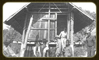
Visited the Rice Bank
When His Majesty visited Karen hill tribe villagers in Chom Thong District, Chiang Mai Province, he presented a quantity of unhusked rice to the village headmen of several villages to serve as initial capital for establishing rice banks. He also provided detailed and clear guidance on the operation, as recorded in the following notes.
“… There shall be a control committee selected from the villagers to safeguard the rice, determine the quantity to lend and receive back, and maintain the accounts and operations of the rice bank. Villagers in need of rice for essential consumption shall record the amount borrowed, and upon harvest, return it to the bank along with a small agreed-upon interest. The interest rice will be kept in the bank as communal property. Committee members have the same rights to borrow rice as other villagers. The principles of the rice bank must be clearly explained to both the committee and villagers in simple terms, ensuring full understanding. Both committee members and villagers must act honestly according to the principles. Borrowed rice, which is communal property, must be returned at the agreed time with interest, except in cases of force majeure, which the committee will review based on facts. Villagers must cooperate to build a strong granary. If these principles are followed, the rice circulating in the bank will never run out, gradually increasing over time, providing rice for consumption for current and future generations. Ultimately, the rice bank will safeguard the interests of villagers and serve as a village food reserve …”
In summary, the government, through various agencies, especially the Department of Community Development, has responded to the royal initiative by extensively expanding the rice bank operations. By 1985, over 4,300 rice banks had been established across 57 provinces, with more than 14.5 million kilograms of rice circulating in these banks. The operational principles of rice banks today can be adapted to the specific problems and needs of each area. For example, services may include free distribution, labor exchange, lending, or borrowing. Operating capital can be obtained through various means, such as donations or issuing shares, and in cases where initial funds cannot be raised independently, projects can be proposed for government budget support.
The rice bank is a social welfare project that effectively transfers income from the rich to the poor and distributes benefits to all parties. Villagers have a communal rice reserve they can borrow for consumption or seed at interest rates far lower than those charged by middlemen, alleviating hardships caused by hunger and scarcity.
The rice bank helps improve the living conditions and income levels of poor farmers, providing an effective and targeted solution. Beyond these tangible results, it also produces less immediately visible but highly important outcomes, as it lays a foundational basis for development. It fosters community cohesion, enabling villagers to learn and take action in solving their own problems—principles that His Majesty King Bhumibol Adulyadej (Rama IX) consistently emphasized: understanding, responsibility, honesty, and a sense of participation. He believed these qualities could be cultivated. The rice bank can serve as an excellent school while also reflecting the efficiency and strength of the community. A successful rice bank does not merely achieve its basic goal of alleviating rice shortages; it also generates additional activities that enhance development, promote participation, cultivate leadership, and strengthen cooperation at the community level. (His Majesty the King and Development Work, 1988: 129–131)
Royal Initiative on the Cattle and Buffalo Bank Project
Currently, the Cattle and Buffalo Bank is widely recognized as a project under the royal initiative aimed at assisting poor farmers who do not own cattle or buffalo. It helps reduce rental burdens and provides farmers with the opportunity to eventually own cattle or buffalo for agricultural labor.
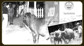
People generally think of banks as being related to money. However, regarding the Cattle and Buffalo Bank, the following is the royal address of His Majesty King Bhumibol Adulyadej (Rama IX) to members of farmer groups nationwide on May 14, 1980, which gave rise to the term “Cattle and Buffalo Bank”:
“… The Cattle and Buffalo Bank is the collection of cattle and buffalo, managed through accounts to oversee, safeguard, distribute, and lend them for agricultural use, while increasing the herd according to the bank’s principles. The Cattle and Buffalo Bank is a new concept in the world, arising out of necessity. At present, there is a tendency to rely on machinery to reduce labor in agriculture. However, as fuel prices rise, the advantages of mechanization are lost, making it necessary to return to using animal labor. This, in turn, creates problems because farmers cannot afford to buy cattle and buffalo for work. The Cattle and Buffalo Bank can be used similarly to a financial bank, since, in general, a bank handles valuable and useful assets. Establishing a Cattle and Buffalo Bank does not mean building a facility to store animals; rather, it creates a central point, such as through the Department of Livestock Development acting as a hub …”
The government, through the Department of Livestock Development, began implementing the Cattle and Buffalo Bank project under the royal initiative in 1979. Initially, 280 buffaloes from the department were provided to assist poor farmers in the lowland areas at the foot of the mountains in Prachinburi Province through a lease-purchase system with repayment over three years. Later, many donors joined the project, allowing it to expand widely to other areas.
Currently, the Cattle and Buffalo Bank under the royal initiative provides services to farmers in the following ways:
Long-term lease-purchase
Poor farmers who wish to own their own cattle or buffalo can purchase them from the bank at a low price, repaying the bank over a three-year period. Buyers must have the village headman, subdistrict chief, or another trusted person act as a guarantor for the repayment.Lease for use
Farmers without their own cattle or buffalo can lease animals from the bank for work at a low rental cost. Lessees must also have the village headman, subdistrict chief, or another trusted person serve as a guarantor with the Cattle and Buffalo Bank.
Loan for Breeding Purposes
Poor farmers who wish to borrow female cattle or buffalo from the bank to raise for breeding can request animals from the bank. Borrowers must share the offspring equally with the bank: the 1st, 3rd, 5th, etc., offspring belong to the bank, while the 2nd, 4th, 6th, etc., belong to the farmer. Borrowers must have the village headman, subdistrict chief, or another trusted person act as guarantor with the bank.Loan for Work Use
Poor farmers or veterans who are genuinely unable to help themselves can request to borrow cattle or buffalo for work. Bank officials will assess and provide assistance on a case-by-case basis. Each village Cattle and Buffalo Bank begins with a minimum of 10 members, all poor farmers in need of cattle or buffalo for labor. The village committee selects members based on poverty, good conduct, diligence, and lack of cattle or buffalo, ranking them in order. The bank allocates animals to selected villagers according to availability, sourced from public donations or government budgets. Those not receiving animals in the first allocation may have an opportunity in subsequent rounds as the bank’s herd grows.
Well-managed village Cattle and Buffalo Banks generate increasing benefits. New offspring belonging to the bank are circulated to serve other farmers, creating a continuous, self-sustaining system. Farmers receive widespread support without requiring large government budgets. Direct benefits include helping poor farmers gain productive assets, reducing high rental costs for animal labor, and providing guarantees that enhance effective production. Indirectly, using appropriate development strategies with traditional labor suits subsistence farming systems, where farmers have limited land and resources. This labor requires no advanced technical knowledge for maintenance. Using cattle and buffalo in rice cultivation fosters natural cooperation and interdependence, allowing farmers to learn and sustain themselves through daily life.
Alternatively, using animal labor also represents the choice of natural energy instead of relying on fuel oil, a resource that is increasingly scarce and expensive. This approach offers multiple benefits that align appropriately with sustainable development. (His Majesty the King and Development Work, 1988: 139–142)
Conclusion
His Majesty King Bhumibol Adulyadej (Rama IX) devoted both his physical efforts and personal resources to closely monitor the well-being of his people for 57 years, never faltering. With his exceptional wisdom, he successfully alleviated the hardships of his subjects quickly and effectively by addressing the core of each problem and making decisions based on reality and suitability. As has been praised:
“… He recognized the suffering of the people and clearly analyzed the root causes of problems.
… He studied methods to solve problems concretely using correct scientific principles.
… He assigned relevant individuals and agencies to implement solutions, monitored the results, and used ‘management’ to coordinate groups to work together efficiently …”
In summary, the royal projects emphasized the development of both the mind and material conditions simultaneously. This can be analyzed from the characteristics and conclusions drawn in the book The Genius King (1996: 36–38) as follows:
Most of the royal development initiatives can be seen as special responsibilities undertaken voluntarily and wholeheartedly by the monarch of a developing democratic country, beyond the normal duties of the state. These development projects addressed various gaps: supplementing what was lacking, integrating separate efforts, and modernizing outdated practices. Considering these initiatives through a general development framework, several key characteristics or qualities can be identified.
Project-Based Structure
The royal projects are structured as formal projects with clearly defined characteristics, consistent with the nature of initiatives under His Majesty’s guidance. These projects supplement regular governmental work, and each has a predetermined duration of operation.Problem-Oriented Approach
His Majesty devoted long periods to closely visiting and interacting with the people, directly receiving petitions and learning about their hardships and difficulties. Naturally, the royal initiatives aim to alleviate problems that are within His capacity to address. Problem-solving is not limited to immediate concerns; many projects, such as the Royal Projects, focus on long-term solutions.Research-Based Foundation
Although the projects emphasize problem-solving, planning and analysis are not reactive or hasty. On the contrary, His Majesty relied on comprehensive and modern information systems, supplemented by field data gathered directly from villagers. Academic issues were discussed freely with scholars, and where knowledge was insufficient, research or experiments were commissioned to expand understanding.Appropriate, Simple, Low-Cost Technology Using Local Wisdom
Since the target group of development consists of poor rural masses who cannot afford expensive modern technology, the projects adopt locally available technologies and materials, combining them with creative innovation. Examples include vetiver grass, water hyacinth, the New Theory approach, and the Monkey Cheek project.Emphasis on Knowledge Transfer, Technology Dissemination, and Scaling
Knowledge is brought to local communities and demonstrated in concrete, understandable ways. This principle underlies the establishment of Development Study Centers in all regions, offering villagers the opportunity to learn and apply the techniques.Responsive Project Implementation
Projects are executed promptly to address urgent problems. For instance, in managing Bangkok’s traffic crises or floods, His Majesty studied and monitored all aspects and stages. When normal agency measures were insufficient, He convened relevant officials, reached decisions, and immediately implemented actions.
Dr. Sumet Tantivejkul, speaking at the “Thammathin, Thammathong Assembly” in April 1996, stated:
“…Just a few months ago, during the floods, His Majesty worked tirelessly day and night—so diligently that many government departments could not keep up. He tracked the situation even before the storms reached Thailand, while we were idle, and while many government agencies, even the government itself, were only organizing fundraising campaigns without concern for actual solutions. He monitored every minute…
…His indirect method was to call meetings and highlight the problem, showing the danger and calculating exactly when and how much. When everyone said, ‘Okay, the meeting is over, we’ll start tomorrow,’ His Majesty commanded, ‘Not tomorrow—now.’”
Monitoring & Evaluation – Although projects often begin with immediate actions to solve problems, they are not temporary or short-lived measures. His Majesty consistently monitored progress and results to ensure effectiveness.
Interdisciplinary & Intersectoral Approach – Most projects aim for rapid results, requiring collaboration across multiple fields and government agencies. This approach contrasts with the traditional bureaucratic culture, which often operates independently.
Humanistic or People-Oriented Philosophy – The core of development is alleviating suffering and improving villagers’ quality of life.
Promotion of Self-Reliance – Projects are designed to enhance individuals’ capacity to help themselves and become self-sufficient.
Sustainability – Development emphasizes the prudent and rational use of natural resources, ensuring long-term sustainability.